Cambrian Way Wales Map and GPX
![]()
![]() This epic long distance trail runs from Cardiff on the south coast of Wales to Conwy on the north coast.
This epic long distance trail runs from Cardiff on the south coast of Wales to Conwy on the north coast.
The trail runs for about 479 km (298 miles) taking you through the heart of the country. You will pass through some spectacular mountainous scenery as you make your way through the Brecon Beacons, the Cambrian Mountains and the Snowdonia National Park.
You'll enjoy riverside trails, huge clear watered lakes and challenging climbs to a series of significant peaks.
Cambrian Way Ordnance Survey Map  - view and print off detailed OS map
Cambrian Way Open Street Map  - view and print off detailed map
*New* - Walks and Cycle Routes Near Me Map - Waymarked Routes and Mountain Bike Trails>>
Cambrian Way OS Map  - Mobile GPS OS Map with Location tracking
Cambrian Way Open Street Map  - Mobile GPS Map with Location tracking
Further Information and Other Local Ideas
Cambrian Way stages
- Starting in Cardiff you head north west along the riverside Taff Trail towards the historic Castle Coch.
- The route continues along the woodland trails through the expansive Fforest Fawr before passing Cefn Onn Park on the way to Rudry.
- You proceed past the little village of Machen and Machen Mountain before a stretch along the edge of the Cwmcarn Forest.
- The next stage takes you to Pontypool, passing the pretty Blaen Bran Reservoir and its adjacent community woodland on the way.
- You continue north through the Brecon Beacons, climbing the to the viewpoint at Blorenge before coming to Abergavenny with its wonderful historic castle and associated gardens.
- Another challenging climb soon follows to Sugarloaf Mountain and then a descent towards Grwyne Fawr Reservoir before another climb to Lord Hereford's Knob (Twmpa), Pen Cerrig Calch and the Iron Age Hill Fort at Table Mountain in the Black Mountains region.
- You'll then descend to the pretty villages of Crickhowel and Llangattock, crossing the Monmouthshire and Brecon Canal and passing through the wonderful scenery of the Craig y Cilau Nature Reserve on the way.
- You proceed west toward Pentwyn Reservoir and Pontsticill Reservoir where you turn north to climb to Fan Y Big and Pen Y Fan. This section also passes the Upper and Lower Neuadd Reservoirs to the west.
- You continue west to the Beacons Reservoir, Fan Gyhirych, Fan Hir, Llyn Y Fan Fawr and Llyn y Fan Fach.
- The next stage takes you north past the expansive Usk Reservoir to the town of Llandovery and then on to Llyn Brianne in the Cambrian Mountains.
- The route passes through the Cambrian Mountans visiting highlights such as the series of delightful lakes at Teifi Pools, the splendid rushing waterfalls at Devil's Bridge Falls and the climb to Plynlimon, the highest point in the Cambrian Mountains.
- The route then enters Snowdonia with early highlights including the riverside paths in the beautiful Dyfi Valley and the historic mill in the lovely town of Dinas Mawddwy.
- One of route's major highlights follows on the climb to Cadair Idris. This area is also a National Nature Reserve with woodland, streams, waterfalls and some wonderful geological formations such as the cliffs of Cwm Cau. Shortly after you pass the Cregennan Lakes and the Arthog Waterfalls before crossing the Mawddach Estuary to the popular coastal town of Barmouth.
- The route then enters a more mountainous section passing Rhinog Fawr and Llyn Cwm Bychan before descending to Llyn Trawsfynydd.
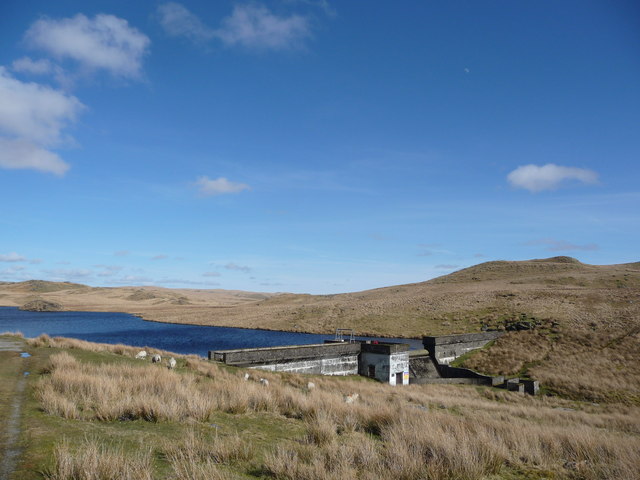
- You'll then pass through the lovely village of Maentwrog in the Vale of Ffestiniog before heading to Tanygrisiau Reservoir and the power station at the photogenic Llyn Stwlan Dam.
- You'll then climb to Cnicht before coming to another major route highlight at the village of Beddgelert. Here you can visit the wonderful Aberglaslyn Pass and enjoy a series of waterfalls.
- Head north from here and you will pass Llyn Dinas before coming to the highest point in Wales at Snowdon. There's a splendid mountain railway here and a number of alternative trails to the summit.
- You continue along Llyn Llydaw to the popular Glyder Fawr and Glyder Fach before more lakeside trails at Cwm Idwal and Llyn Ogwen.
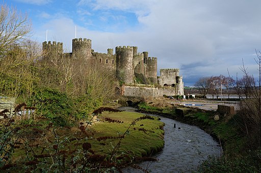
- The final section passes the spectacular Carneddau before descending Conwy Mountain to the North Wales coast at Conwy.
On the route you can link up with two more long distance trails in the shape of the Brecon Beacons Way and the Snowdonia Slate Trail.
Cycle Routes and Walking Routes Nearby
Photos
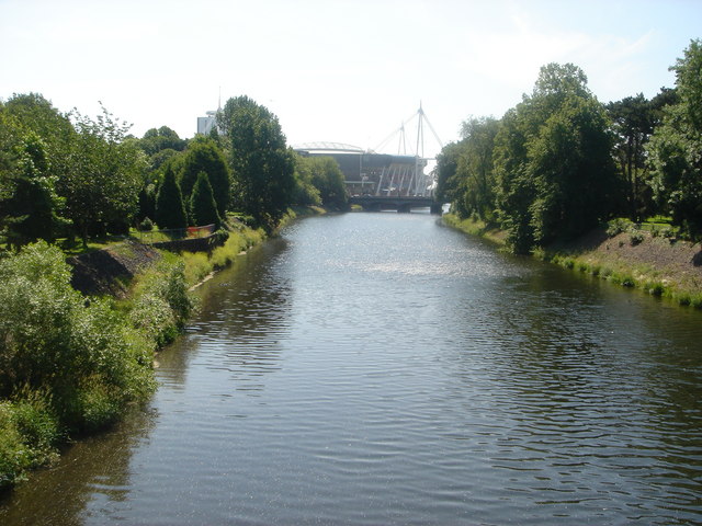
Afon Taf Cardiff, near the southern end of the route. View over the River Taff looking towards the Arms Park and Millennium Stadium with Bute Park to the left. The Taff Trail is on the right bank.
On the Blorenge in the Brecon Beacons near Abergavenny. The route traverses a wide range of habitats, each with its own distinctive flora and fauna. The southern sections of the trail pass through limestone grasslands and heathlands, where plants such as wild thyme, rock rose, and common heather thrive. As the trail ascends into the Brecon Beacons, you’ll encounter upland species like bilberry and mosses adapted to the damp, cooler conditions. The central sections of the trail, particularly through the Cambrian Mountains, feature boggy moorlands with sphagnum moss, cotton grass, and insectivorous plants like sundews and butterwort.
Lord Hereford's Knob or Twmpa. The fauna along the Cambrian Way is just as varied. Red kites and buzzards are frequently seen soaring above, while pied flycatchers and redstarts nest in the wooded valleys. In the upland areas, you may spot meadow pipits, skylarks, and the elusive ring ouzel. Mammals such as foxes, badgers, and hares inhabit the lower landscapes, while wild ponies roam freely in areas like the Brecon Beacons. In wetter sections, frogs, newts, and dragonflies are common, particularly near ponds and streams.
Table mountain. This Table Mountain is a smaller hill compared to its famous South African counterpart but offers dramatic views of the surrounding landscape, including the Snowdon massif and the surrounding valleys.
The summit of Table Mountain in Wales rises to 627 metres (2,057 feet) and is known for its distinct flat-topped shape, similar to the more famous Table Mountain in South Africa. The peak is often shrouded in mist, adding to the atmospheric appeal of the area. The mountain is easily accessible from Capel Curig and is a popular short hike for those looking to experience the natural beauty of Snowdonia without tackling the larger peaks like Snowdon itself.
Flora on Table Mountain includes typical upland species such as heather, bilberry, and bracken. The surrounding area is rich in biodiversity, with a mix of heathland and woodlands. In spring and summer, wildflowers add splashes of colour to the landscape, including species such as primroses and bluebells.
The fauna is also diverse, with common sightings of birds like kestrels, buzzards, and ravens soaring above the mountain. The slopes are home to small mammals such as rabbits, as well as the occasional red squirrel, which can still be found in parts of Snowdonia.
The views from the summit of Table Mountain offer spectacular panoramas of the surrounding valleys, lakes, and other mountains in Snowdonia, including Tryfan, the Glyderau range, and the Carneddau hills. On clear days, visitors can see as far as Anglesey and the North Wales coast. The mountain is a great spot for photographers and those looking for a peaceful retreat in the heart of Snowdonia.
Towards Pen y Fan. The trail also showcases some of Wales’ most stunning natural and cultural landmarks. The Brecon Beacons feature dramatic ridges and peaks like Pen y Fan, the highest point in southern Britain. Further north, the trail crosses Snowdonia National Park, home to rugged mountains, including Snowdon, the highest peak in Wales. Along the way, walkers can explore historic castles, ancient standing stones, and picturesque villages such as Crickhowell and Betws-y-Coed.


