Manor Park Country Park
![]()
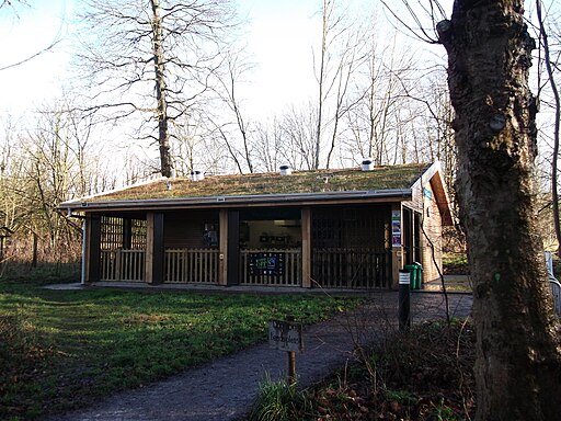
![]() Located near Maidstone in Kent, this 52 acre country park has fields, wildflower meadows and a lake with swans, herons, moorhens and dabchicks. The park has a number of footpaths making it an ideal place for an afternoon stroll. There's also good on site facilities with a play area, cafe and picnic area.
Located near Maidstone in Kent, this 52 acre country park has fields, wildflower meadows and a lake with swans, herons, moorhens and dabchicks. The park has a number of footpaths making it an ideal place for an afternoon stroll. There's also good on site facilities with a play area, cafe and picnic area.
The park is located in the town of West Malling so you could visit the park from the nearby train station. See the West Malling Walk for more details on this.
Postcode
ME19 6PE - Please note: Postcode may be approximate for some rural locationsPlease click here for more information
Manor Park Country Park Ordnance Survey Map  - view and print off detailed OS map
Manor Park Country Park Open Street Map  - view and print off detailed map
Manor Park Country Park OS Map  - Mobile GPS OS Map with Location tracking
Manor Park Country Park Open Street Map  - Mobile GPS Map with Location tracking
Pubs/Cafes
There is a good on site cafe selling a range of meals and snacks at reasonable prices.
Dog Walking
The park is popular with dog walkers with its meadows and parkland trails.
Further Information and Other Local Ideas
To continue your walking in the area head east into Maidstone and try our Maidstone River Walk which takes you along the River Medway.
Mereworth Woods are located just to the south west of the park. There's ancient woodland with miles of trails to try here.
Just to the south there's neighbouring Kings Hill where you can visit the wildlife rich Warren Woods Nature Park and enjoy the greenways which are suitable for cyclists and walkers.
Cycle Routes and Walking Routes Nearby
Photos
Footbridge in Manor Park Country Park. The stream from West Malling widens out to make a lake. The bridge crossing it, leads from car park footpath in park to St.Leonard's Street.
Entrance to Manor Park Country Park. On bend in Lavender Road. Beside unnamed cottage. Path leads through cattle field downhill to the lake.


