Walks Around Kings Hill Kent
![]()
![]() This Kent based village is located in the borough of Tonbridge and Malling near West Malling.
This Kent based village is located in the borough of Tonbridge and Malling near West Malling.
Local walking highlights include the expansive Mereworth Woods where there are miles of woodland trails to try. To the north there's Manor Park Country Park in the neighbouring village of West Malling.
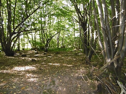
On the eastern side of the village there's the Warren Woods Nature Park where you can explore some local ancient woodland. It's great for wildlife including badgers, foxes, bats, dormouse, as well as many woodland birds, reptiles and insects, including a variety of butterflies and bees. This walk starts in the village and takes you east to explore the park where you can find pretty bluebells in the spring.
The village also includes a number of greenways suitable for walking or cycling.
Please click here for more information
Kings Hill Ordnance Survey Map  - view and print off detailed OS map
Kings Hill Open Street Map  - view and print off detailed map
Kings Hill OS Map  - Mobile GPS OS Map with Location tracking
Kings Hill Open Street Map  - Mobile GPS Map with Location tracking
Walks near Kings Hill
- West Malling - The historic market town of West Malling is located in the Tonbridge and Malling district of Kent, a few miles west of Maidstone
- Manor Park Country Park - Located near Maidstone in Kent, this 52 acre country park has fields, wildflower meadows and a lake with swans, herons, moorhens and dabchicks
- Maidstone River Walk - A nice riverside walk along the Medway from Maidstone to Leybourne Lakes Country Park
- Mereworth Woods - These large woods near Sevenoaks have miles of mountain bike trails and woodland walks to enjoy
- Leybourne Lakes Country Park - Enjoy peaceful, waterside walking and cycling at Leybourne Lakes Country Park, near Maidstone in Kent
- Bearsted - This attractive Kent based village has a pretty village green, a local community run woodland park and easy access to the footpaths on the North Downs.
- Hollingbourne - This attractive Kent based village has some fine trails through the North Downs to try
- Hucking Estate - Enjoy a peaceful stroll through the ancient woodland and open grassland of the Hucking Estate in the Kent Downs AONB
- Detling Hill - This walk climbs to Detling Hill, just to the east of the village of Detling in Kent
- Snodland - This riverside town is located in the borough of Tonbridge and Malling in Kent


