Market Deeping Walks
![]()
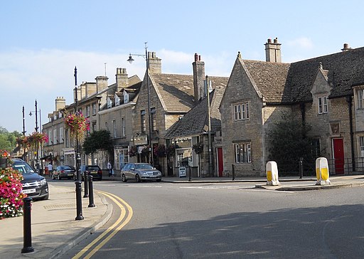
![]() This Lincolnshire based market town is located on the River Welland in the South Kesteven district of the county, a few miles north of the city of Peterborough.
This Lincolnshire based market town is located on the River Welland in the South Kesteven district of the county, a few miles north of the city of Peterborough.
It's an historic place with several 17th century stone buildings, a weekly market dating back to 1220 and a well known stone bridge from the mid 17th century.
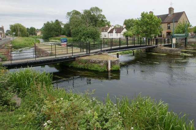
This walk in the town takes you along the riverside public footpaths heading south east towards Deeping St James and Peakirk.
The walk can be started on Market Deeping Bridge in the town. Then follow the tree lined footpath east with some lovely views along the peaceful river. The route continues towards Peakirk where you will find the Deeping Lakes Nature Reserve. The Reserve is run by
Lincolnshire Wildlife Trust and is a great place for spotting water loving birds and other wildlife in the area.
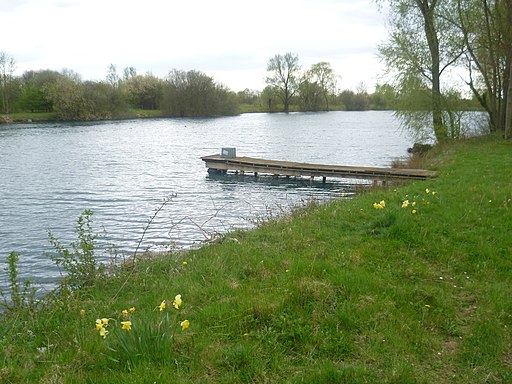
For an alternative walk from Market Deeping head north west to the Tallington Lakes Leisure Park. There are some public footpaths here with views over the pretty lakes.
Market Deeping Ordnance Survey Map  - view and print off detailed OS map
Market Deeping Open Street Map  - view and print off detailed map
Market Deeping OS Map  - Mobile GPS OS Map with Location tracking
Market Deeping Open Street Map  - Mobile GPS Map with Location tracking
Walks near Market Deeping
- Peterborough - There's lots of fairly easy walks to enjoy around the cathedral city of Peterborough
- Bourne Woods Lincolnshire - Enjoy miles of woodland cycling and walking trails in this large forest in the market town of Bourne, Lincolnshire
- Grimsthorpe Castle - This fine country house has an expansive estate to explore on a number of footpaths
- Bedford Purlieus National Nature Reserve - These splendid ancient woods near Peterborough have miles of woodland walking trails to try
- Hereward Way - Starting in Oakham, in Rutland, follow the Herward Way through Stamford, Peterborough, Ely, and the Breckland forests to Thetford, in Norfolk
- Ferry Meadows Country Park - This super country park in Peterborough has several pretty lakes with cycling and walking trails running alongside the water's edge
- Castor Hanglands - Explore the woodland, limestone, wetland grassland and scrub in this large National Nature Reserve near Peterborough
- Crown Lakes Country Park - Enjoy a stroll around the pretty lakes in this country park in Peterborough
- Torpel Way - This walk runs from Peterborough to Stamford through countryside and agricultural land
- Wansford - This picturesque Cambridgeshire village sits in a nice location on the River Nene, near the border with Northamptonshire
- Holme Fen - Explore the largest Silver Birch woodland in lowland England on this walk in Cambridgeshire
- Kings Cliffe Railway Walk - This walk takes you along the old disused railway line in the Northamptonshire village of King's Cliffe.
- Fineshade Woods - Top Lodge in Fineshade Woods has several waymarked cycling and walking trails
- Blatherwycke Lake - This walk visits the little Northamptonshire village of Blatherwycke where you can enjoy a stroll along the pretty lake
- Whittlesey Heritage Walk - This circular walk takes you to a series of historical sites in the Cambridgshire town of Whittlesey.
- Stamford - The Lincolnshire town of Stamford has a number of good options for walkers visiting the area
Pubs/Cafes
The village is well known for its wide range of restaurants and its two notable fish and chip shops: The Boundary, which won the East of England Fish and Chip Shop of the Year award in 2007, and Linford's which was one of seven runners-up in the National Fish and Chip Awards in 2012.
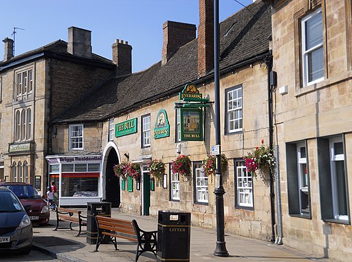
For a pub lunch there's The Bull, a coaching inn dating back to the 16th century. It has a lovely olde worlde feel featuring oak beams, flagstones and exposed stone walls. You can find them on the Market Square at postcode PE6 8EA for your sat navs. They are dog friendly outside.


