Moel Arthur Walk
![]()
![]() This short climb follows the Offa's Dyke Path from the Clywd Forest to Moel Arthur in the Clwydian Range AONB.
This short climb follows the Offa's Dyke Path from the Clywd Forest to Moel Arthur in the Clwydian Range AONB.
You can start the walk from the car park at the eastern end of the Clywd Forest, about a mile north west of Moel Arthur. You then follow good footpaths to the summit where there are lovely views over the Vale of Clywd and the other mountains on the Clwydian Range. In the autumn months the hill slopes are a lovely site, covered in pretty heather. The area also has an interesting history with an Iron Age Hillfort and some of the largest banks and ditches in the area.
If you would like to extend your walking in the area then you could continue south along the Offa's Dyke Path to the nearby Moel Famau Country Park.
Here you can climb the 1818ft high Moel Famau for wonderful views of the Wirral, Merseyside, Snowdonia, the Dee Valley and the coast.
Postcode
LL16 4NB - Please note: Postcode may be approximate for some rural locationsMoel Arthur Ordnance Survey Map  - view and print off detailed OS map
Moel Arthur Open Street Map  - view and print off detailed map
*New* - Walks and Cycle Routes Near Me Map - Waymarked Routes and Mountain Bike Trails>>
Moel Arthur OS Map  - Mobile GPS OS Map with Location tracking
Moel Arthur Open Street Map  - Mobile GPS Map with Location tracking
Explore the Area with Google Street View 
Pubs/Cafes
You could head into the nearby village of Bodfari for some refreshments after your walk. It's located about 2 miles north west of the hill and can be reached by following the Offa's Dyke Path. In the village you will find The Dinorben Arms, a traditional pub steeped in history. It has an attractive interior, a great menu and good selection of drinks. There's also a fabulous outdoor terrace where you can relax outside and soak in the views of the surrounding hills and countryside. You can find the pub at postcode LL164DA for your sat navs.
It's worth exploring the pretty village too where you can visit the Church of St Stephen, which lies at the heart of the settlement, and has its origins in medieval times, dating back to at least the eleventh century.
On the Bodfari Walk you can climb to Moel-y-Gaer Hill fort which stands on a hill to the north of the settlement.
Cycle Routes and Walking Routes Nearby
Photos
The Offa's Dyke path drops down steeply to the car park. This shows the Hill Fort near the top and the old quarries on the hill side.
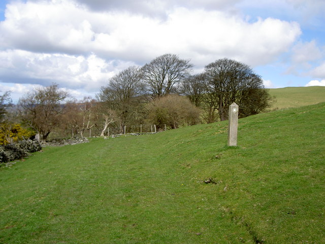
Offa's Dyke Path heading north-west from Moel Arthur. From here the path drops down to a valley before skirting the left flank of Penycloddiau (hill on left middle distance) via the top edge of the plantation, Coed Llangwyfan
Moel Arthur Car-park. Marked on the map, no fewer than 6 paths nearby and completely free makes this car-park quite popular
Elevation Profile


