Moel Y Parc
![]()
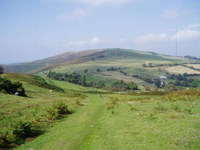
![]() This walk takes you up to the transmitting station on Moel Y Parc in the Clwydian mountain range.
This walk takes you up to the transmitting station on Moel Y Parc in the Clwydian mountain range.
The hill sits on the border between Denbighshire and Flintshire and stands at a height of 398 metres (1,306 ft). At the top you'll find a Television Transmitter and fine views over the surrounding countryside. Next to the hill you can also pick up the epic Clwydian Way and explore the surrounding hills further.
Moel Y Parc Ordnance Survey Map  - view and print off detailed OS map
Moel Y Parc Open Street Map  - view and print off detailed map
Moel Y Parc OS Map  - Mobile GPS OS Map with Location tracking
Moel Y Parc Open Street Map  - Mobile GPS Map with Location tracking
Further Information and Other Local Ideas
To extend your walking in the area you could head south to climb to the significant Iron Age Hillfort at Penycloddiau. You can follow the Offa's Dyke Path south to visit the hill. Moel Arthur, the popular Moel Famau Country Park and the Moel-y-Gaer Hill fort in Bodfari are also nearby.
The hill is also located just a few miles north east of Denbigh where you can explore the remains of the historic 13th century castle.
Cycle Routes and Walking Routes Nearby
Photos
Moel y Parc Television Transmitter. The Moel-y-Parc television mast is situated on Moel-y-Parc, a hill in north-east Wales at the northern end of the Clwydian range, close to the town of Caerwys and several kilometres north-east of Denbigh. It has been on the air since 1963. The mast is 235 metres high, and its overall height above sea level is approximately 575 metres. Its official coverage area includes parts of Flintshire, Denbighshire and Wrexham


