Mulbarton Walks
![]()
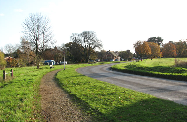
![]() This Norfolk based village is located just south of Norwich. It's a pleasant place for a walk with a pretty village green, a pond, a common and a 17th century pub to relax in after your exercise.
This Norfolk based village is located just south of Norwich. It's a pleasant place for a walk with a pretty village green, a pond, a common and a 17th century pub to relax in after your exercise.
This circular walk explores the common before following country footpaths into the pleasant countryside to the east of the settlement. On the way you will pass the noteworthy church which has a tower dating back to the 14th century and some fine 15th century stained glass.
The Tas Valley Way also passes through the village. The long distance trail runs from Cringleford, near Norwich, to Attleborough, with waterside sections along the River Tas. Mulbarton is also on the Hethersett and Swardeston Country Walk which runs between the two neighbouring villages.
Postcode
NR14 8JT - Please note: Postcode may be approximate for some rural locationsMulbarton Ordnance Survey Map  - view and print off detailed OS map
Mulbarton Open Street Map  - view and print off detailed map
Mulbarton OS Map  - Mobile GPS OS Map with Location tracking
Mulbarton Open Street Map  - Mobile GPS Map with Location tracking
Walks near Mulbarton
- Norwich Riverside Walk - This circular walk around the city centre of Norwich follows the lovely riverside path along the River Wensum
- Tas Valley Way - This 25 mile river walk runs from Cringleford, near Norwich, to Attleborough, visiting a series of pretty villages with historic churches along the way.
- Hethersett and Swardeston Country Walk - This village near Norwich has some nice surrounding countryside to explore on a number of footpaths
- Wymondham Tiffey Valley Walk - This walk follows footpaths along the River Tiffey in the Norfolk town of Wymondham.
- Ketts Country Walk - Follow Kett's Country Walk from Cringleford to Wymondham on this splendid walk through Norfolk
- Attleborough - This Norfolk based town has some nice trails to follow through the surrounding valley of the River Tas
- Whitlingham Country Park - Enjoy a peaceful cycle or walk around the lovely Whitlingham Country Park on the outskirts of Norwich
- Caistor St Edmund - This historical circular walk explores the Roman town of Caistor St Edmund in Norfolk
- Wherryman's Way - This walk follows the River Yare between Norwich and Great Yarmouth through the Norfolk Broads.
- Shotesham - This south Norfolk village is located just a few miles to the south of the city of Norwich in the River Tas Valley.
- Old Buckenham - This Norfolk based village sits just to the south of Attleborough on the popular Tas Valley Way walk
- Cringleford - This Norfolk based village is located on the outskirts of Norwich just south of the University of East Anglia on the River Yare
- Yare Valley - Follow the River Yare from Bowthorpe to Marston Marsh on this deilghtful riverside walk near Norwich
- Marston Marshes - This pretty nature reserve is located on the River Yare near Cringleford and Norwich.
- Ketteringham Hall - Ketteringham Hall is located in the Norfolk village of Ketteringham, a few miles south west of Norwich.
Pubs/Cafes
Back in the village you can enjoy some post walk refreshment at the World's End. The historic pub dates back to the 1600s when it was an important Coaching Inn. They serve good food and have an award winning Garden area for warmer days. You can find them at postcode NR14 8JT for your sat navs.
Further Information and Other Local Ideas
Just to the north west there's the historic Ketteringham Hall to explore. There's some lovely grounds and gardens which you can visit in May on one of the popular bluebell walk days. You can also access the grounds from the delightful Orangery tea room.
Photos
Photo of the tithe barn in Mulbarton. The former 140 ft long tithe barn on the edge of the Common used to be divided into hay barn, chaff cutting shed, corn barn, and a stable for four horses. It has since been converted into accommodation and The Coach House and Stable are two holiday flats incorporated in the western end of the building.
The church of St Mary Magdalen is situated by the northern end of the common which covers an area of 45 acres. The tower dates from the late 14th century and the chancel, as we see it today, was rebuilt later. North aisle and south porch date from a 19th century restoration. The church still houses the original medieval font. The most interesting feature of St Mary's is its 15th century stained glass some of which was moved to here from St Mary's church in Martham in the 19th century. An interesting and unusual memorial dating from the 17th century can be found on the south side of the chancel arch: two copper plates are resting on a bible which has been set into the wall. The copper plates open like a book, revealing the epitaph of 'the most Religious Mrs Sarah Scargill'.
Pond and church. The pond and the church of St Mary Magdalen stand at the northern end of Mulbarton Common.


