Mytholmroyd Walks
![]()
![]() This historic Yorkshire village is a lovely place to start a walk. There's several interesting old buildings, canalside trails, local hill climbs and old industrial sites to see. There's also a train station so it's easily accessible by public transport.
This historic Yorkshire village is a lovely place to start a walk. There's several interesting old buildings, canalside trails, local hill climbs and old industrial sites to see. There's also a train station so it's easily accessible by public transport.
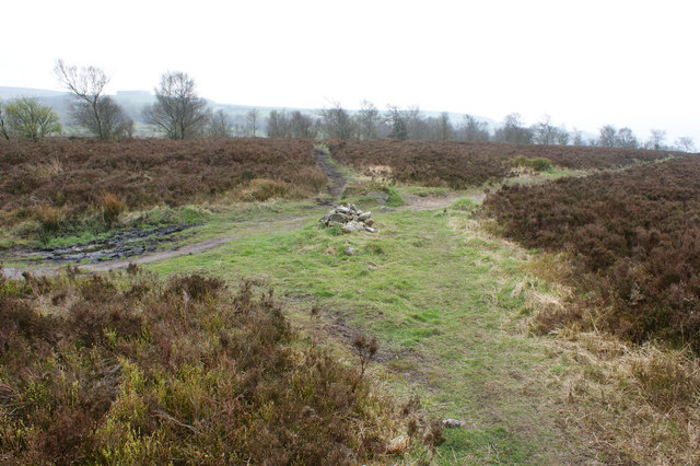
This circular walk from the village train station explores the hills to the south of the settlement. You'll climb to Windle Hill, Weather Hill, Aaron Hill and Crow Hill which stands at 383 metres high. There are some excellent views over the surrounding moors, towns and villages from this elevated spot.
The route then descends to Blackwood Common before coming to the Rochdale Canal. You can then enjoy an easy waterside stroll back to the village and the train station.
The walk can be extended by following the canal east to Sowerby Bridge or West to Hebden Bridge. You'll also come close to Cragg Vale which lies just to the west of the route. The village is known for The Cragg Vale Coiners, a band of counterfeiters that produced fake gold coins in the late 18th century to supplement small incomes from weaving. It lies very close to the pretty Withens Clough Reservoir where there are some lovely waterside trails.
Mytholmroyd Ordnance Survey Map  - view and print off detailed OS map
Mytholmroyd Open Street Map  - view and print off detailed map
Mytholmroyd OS Map  - Mobile GPS OS Map with Location tracking
Mytholmroyd Open Street Map  - Mobile GPS Map with Location tracking
Walks near Mytholmroyd
- Hebden Bridge - This circular walk makes use of the Haworth-Hebden Bridge Walk, the Calderdale Way and the Rochdale Canal to take you on a tour of the countryside, woodland, moors and hills surrounding this attractive Yorkshire town.
The market town of Hebden Bridge sits on the River Calder and the Rochdale Canal in the Upper Calder Valley - Hebden Bridge Canal Walk - Enjoy a waterside walk from Hebden Bridge to Sowerby Bridge along a lovely section of the Rochdale Canal
- Hebdon Bridge to Heptonstall Walk - This circular walk takes you from Hebdon Bridge to the nearby village of Heptonstall before exploring the area to the west of the settlements
- Rochdale Canal - Follow the Rochdale canal from Manchester to Sowerby Bridge on this waterside route through Greater Manchester and Yorkshire
- Withens Clough Reservoir - Enjoy an easy circular walk around this attractive reservoir in the south Pennines
- Stoodley Pike - This circular walk takes you to the Stoodley Pike monument from Todmorden
- Hardcastle Crags - Explore this beautiful wooded valley in the South Pennines on this walk around Hardcastle Crags
- Haworth-Hebden Bridge Walk - This walking path takes you through some beautiful Yorkshire countryside from Haworth to Hebden Bridge
- Calderdale Way - The Calderdale Way is a walking circuit around the beautiful district of Calderdale in West Yorkshire
- Lumb Hole Falls - This walk visits a series of waterfalls just to the north of Hebden Bridge
- Cragg Vale - The small village of Cragg Vale is located near Mytholmroyd in the Calderdale area of the South Pennines
- Luddenden and Luddenden Foot - This walk visits the pretty villages of Luddenden and Luddenden Foot in Calderdale, Yorkshire.
Pubs/Cafes
The Shoulder Of Mutton Inn is in a great spot by the river. You can sit outside in the garden and enjoy a view of the water with your meal. The pub does a find Sunday lunch and can be found on New Road at postcode HX7 5DZ.
Photos
Crow Hill. Triangulation pillar (flush bracket number S4371) on the exposed top of Crow Hill at 383 metres above sea level. The tiny spike on the distant horizon is the 110 foot high Stoodley Pike.


