Normanton Walks
0.7 miles (1.2 km)
![]()
![]() This West Yorkshire town is located in the City of Wakefield.
This West Yorkshire town is located in the City of Wakefield.
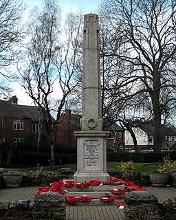
This walk in the town takes you around Haw Hill Park where there are some nice surfaced footpaths, a duck pond and lawned areas. The park also includes a play area, gym areas, memorials and tennis courts.
Postcode
WF6 2HB - Please note: Postcode may be approximate for some rural locationsNormanton Ordnance Survey Map  - view and print off detailed OS map
Normanton Open Street Map  - view and print off detailed map
Normanton OS Map  - Mobile GPS OS Map with Location tracking
Normanton Open Street Map  - Mobile GPS Map with Location tracking
Walks near Normanton
- Wakefield - This Yorkshire town is a great base for walkers with numerous local parks, canalside trails, several nearby reservoirs and riverside paths along the Calder.
- Pugneys Country Park - This 250 acre park contains two lakes with pleasant waterside footpaths
- Newmillerdam Country Park - Enjoy cycling and walking paths in this popular country park in Wakefield
- Wintersett Reservoir - This pretty reservoir near Wakefield has a nice walking trail running along the western side of the water
- Anglers Country Park - Enjoy a peaceful walk or cycle around this pretty country park in Wakefield
- Nostell Priory - Explore 300 acres of parkland and gardens surrounding this 18th-century treasure house near Wakefield
- Wakefield Canal - Follow the Wakefield Branch of the Aire and Calder Navigation Canal from Wakefield to Castleford on this waterside walk in West Yorkshire
- Barnsley Canal - Enjoy a waterside walk or cycle along the Barnsley Canal on this easy route near Royston
- Ardsley Reservoir - This circular walk takes you around Ardsley Reservoir in East Ardsley, near Tingley in Leeds
- Fitzwilliam Country Park - Enjoy a short circular walk or cycle along the network of way-marked paths in this pretty country park in the Wakefield area of Yorkshire
- Hemsworth Water Park - Enjoy a short stroll along the lakes in this lovely park near Wakefield
- Ryburn Reservoir and Baitings Reservoir - This walk visits these two pretty reservoirs near Rishworth in West Yorkshire
- Walton Hall Park - A walk around the pretty parkland surrounding Walton Hall in Wakefield
- Ossett - This West Yorkshire market town is located in the Wakefield area of the county
- Morley - This West Yorkshire town is located close to Leeds and Wakefield
- Allerton Bywater - This village near Leeds has a series of pleasant waterside footpaths to try
- Castleford Greenway - This route follows the Castleford Greenway and the Trans Pennine Trail from Castleford to Wakefield in Yorkshire.


