Northampton Canal Walk
![]()
![]() This easy walk follow the Northampton Arm of the Grand Union Canal from the town centre to the countryside near Milton Malsor. It runs for a distance of about 5 miles along a nice flat path with views of the River Nene and the surrounding Northamptonshire countryside on the way.
This easy walk follow the Northampton Arm of the Grand Union Canal from the town centre to the countryside near Milton Malsor. It runs for a distance of about 5 miles along a nice flat path with views of the River Nene and the surrounding Northamptonshire countryside on the way.
The walk starts the Towcester Bridge which runs over the River Nene and the canal in the town centre. Follow the towpath west and it will take you past Briar Hill Meadows and Duston Mill Reservoir.
The canal continues south towards Rothersthorpe before coming to Gayton Junction where there is a nice marina at the end of the route. The village of Gayton is a short stroll from here so you could head there for refreshments.
You can extend the walk at Gayton Junction by picking up the Grand Union Canal and heading west to Bugbrooke. Heading south east along the towpath will take you to Stoke Bruerne.
Northampton Canal Walk Ordnance Survey Map  - view and print off detailed OS map
Northampton Canal Walk Open Street Map  - view and print off detailed map
Northampton Canal Walk OS Map  - Mobile GPS OS Map with Location tracking
Northampton Canal Walk Open Street Map  - Mobile GPS Map with Location tracking
Walks near Northampton
- Grand Union Canal Walk - Follow the towpath of Britain's longest canal from London to Birmingham on this fabulous waterside walk
- Stoke Bruerne - This walk follows the Grand Union Canal Walk from Stoke Bruerne to Cosgrove.
- Nene Way - Follow the River Nene through the beautiful Nene Valley on this fabulous walk through Cambridgeshire, Lincolnshire and Northamptonshire.
The long distance path runs for over 100 miles, passing Northampton, Wellingborough, Oundle, Peterborough and Wisbech.
There's much to enjoy on the way with rushing weirs, a series of historic villages and old mills - Harlestone Firs Forest Walk - This circular walk visits the popular Harlestone Firs in Northamptonshire
- Castle Ashby - This circular walk takes you around the village of Castle Ashby and its associated gardens.
- Sywell Country Park - Follow the waterside path around the delightful Sywell Reservoir on this easy walk in Northamptonshire
- Wellingborough - The Northamptonshire town of Wellingborough has some lovely walking trails to follow through the Nene Valley
- Delapre Abbey Park - Explore the grounds of a neo-classical mansion on this walk in Northampton
- Hunsbury Hill Country Park - This country park and Iron Age hill fort are located just to the south of Northampton.
- Northamptonshire Round - This waymarked long distance walk runs for just over 50 miles through the countryside and villages surrounding Northampton.
Further Information and Other Local Ideas
A few miles north west of Northampton you'll find the Harlestone Firs Forest Walk. This popular woodland area contains miles of peaceful trails on Lord Spencer's Althorp Estate. Near the woods you can also visit Althorp House, the childhood home of Princess Diana. Here you can learn about 500 years of history and explore the beautiful grounds and gardens.
The Nene Way also passes through the town. The lovely riverside trail could be followed east towards Cogenhoe and Wellingborough or west to Kislingbury.
A few miles south east of the town there's the historic Castle Ashby. Here you'll find a fine manor house surrounded by 35 acres of parkland including Italian Gardens, an Orangery, an Arboretum and a series of pretty ponds.
Just to the east there's Sywell Country Park where there's a nice waterside trail around a pretty lake.
On the southern side of the river and canal you will find Delapre Abbey Park. There's 500 acres of parkland, lakes, woodland and gardens to explore on this popular historic site.
For more walking ideas in the area see the Northamptonshire Walks page.
Photos
Northampton Arm, Grand Union Canal. A weed-choked stretch of canal allowing only single-file boat traffic. The bridge carrying the Northampton Ring Road can be seen in the background.
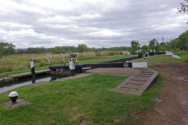
No 15 Lock. The Northampton Arm was built in 1815, connecting the Grand Union's main line at Gayton Junction and the River Nene, falling through 17 locks in five miles.
No 16 Lock. The penultimate lock in the descent from Gayton Junction to the River Nene. This stretch of canal is not heavily used by pleasure boaters and the lock has a slightly neglected feel.
Milepost at Gayton Junction. Almost 17 miles by the Grand Union main line to Braunston or just five - and 17 locks - down to the Nene at Northampton.


