Penryn Walks
![]()
![]() This Cornish based town has some lovely river and coastal walks to try. It's an attractive and historic town with several buildings dating from Tudor, Jacobean and Georgian times. As such the town is an important conservation area with the centrepiece the Town Hall Clock which dates from 1839.
This Cornish based town has some lovely river and coastal walks to try. It's an attractive and historic town with several buildings dating from Tudor, Jacobean and Georgian times. As such the town is an important conservation area with the centrepiece the Town Hall Clock which dates from 1839.
This walk from the town takes you along the Penyrn River to nearby Flushing.
The walk starts in the town centre and follows a footpath along the harbour towards Gorrangorra. You continue east along the river towards Trevissome House before finishing on the Quays at Flushing. There's some nice views over the river to Falmouth on the opposite side here. You can also catch the Flushing Ferry over the river to visit the bustling port.
Postcode
TR10 8FG - Please note: Postcode may be approximate for some rural locationsPenryn Ordnance Survey Map  - view and print off detailed OS map
Penryn Open Street Map  - view and print off detailed map
Penryn OS Map  - Mobile GPS OS Map with Location tracking
Penryn Open Street Map  - Mobile GPS Map with Location tracking
Pubs/Cafes
The Muddy Beach is in a great location for some post walk refreshment. It's positioned right next to the river so you can sit outside and enjoy a meal while admiring the boats in the harbour. It takes it's name from the beach directly outside where you can look out for a variety of wading birds. You can find them at Jubilee Wharf, with a postcode of TR10 8FG for your sat navs.
Dog Walking
The riverside paths make for a pleasant dog walk. The Muddy Beach mentioned above is also dog friendly.
Further Information and Other Local Ideas
Just to the south west of the town there's College Reservoir and Argal Reservoir to explore. There's a nice circular trail around the lake with lovely countryside views over the water and a noteworthy ancient church on the western side.
Just to the north east there's the worthy village of Mylor Bridge where you can enjoy some lovely waterside walks along the Mylor Creek and Restronguet Creek, on the beautiful Fal Estuary.
For more walking ideas in the area see the Cornwall Walks page.
Cycle Routes and Walking Routes Nearby
Photos
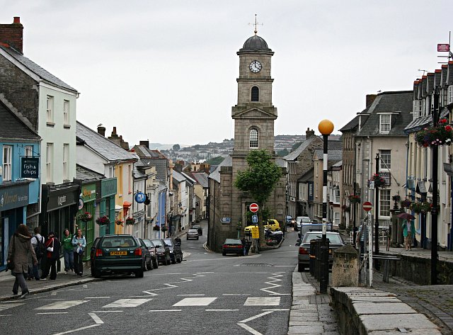
Town Centre. The prominent building with the clock tower is Penryn Town Hall and Museum, formerly the Market Hall. It sits between Higher Market street on the right and Lower Market Street on the left. The street plan of this area has not changed since this was a medieval market place with the houses and shops at the front of narrow medieval burgage strips. This is still the commercial core of Penryn but it is obviously no longer a major shopping centre as it has been since medieval times. There is distinct lack of the normal high street shops.
Jubilee Wharf. This award-winning development by the architect, Bill Dunster, is a mixed-use redevelopment of an old coalyard and is noted for its low-energy design, employing wind turbines, solar heating and natural ventilation.
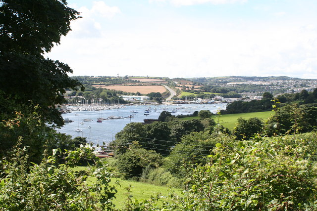
Slipway at Trevissome. Looking across the river with Falmouth Marina in the centre left, on the other side.
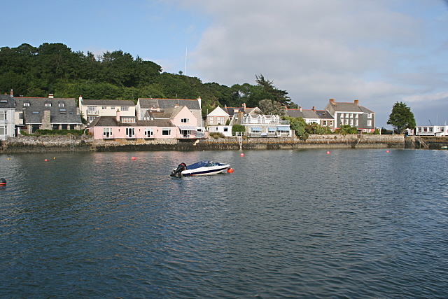
The Flushing Ferry. Taken from the jetty at Flushing village, this photograph gives a good overview of the grid square which extends over the Penryn River and includes the houses of Falmouth going up the hillside behind. The ferry itself is probably the smallest ferry visiting Falmouth Town Pier but it provides an important service between Falmouth and Flushing for local people and holidaymakers alike.


