Porthkerry Country Park
![]()
![]() Explore 220 acres of woodland, meadows and coast in this super country park near Barry in the Vale of Glamorgan.
Explore 220 acres of woodland, meadows and coast in this super country park near Barry in the Vale of Glamorgan.
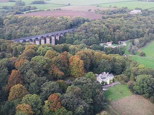
The route starts at the car park on the coast and takes you along the pretty pebble beach before turning inland into the woodland on nature trails. You will pass through the pretty grassland with its wildflower meadow and calming stream. You will also pass Viaduct wood with super views of the impressive Porthkerry Viaduct. The route below is designed for walkers but a nice easy cycle track runs through the centre of the park just up from the coast. It makes for a nice, safe ride for families.
Facilities in the park include an excellent cafe, chidlren's play area and a 12 hole golf course.
You can extend the walk by heading south west to visit Rhoose Point, the most southerly point of mainland Wales. The popular seaside resort of Barry Island is also located just to the south east.
Postcode
CF62 3BY - Please note: Postcode may be approximate for some rural locationsPlease click here for more information
Porthkerry Country Park Ordnance Survey Map  - view and print off detailed OS map
Porthkerry Country Park Open Street Map  - view and print off detailed map
*New* - Walks and Cycle Routes Near Me Map - Waymarked Routes and Mountain Bike Trails>>
Porthkerry Country Park OS Map  - Mobile GPS OS Map with Location tracking
Porthkerry Country Park Open Street Map  - Mobile GPS Map with Location tracking
Pubs/Cafes
The park has an on site cafe selling a good range of snacks and meals. Marcos in the Park is situated in the main car park and sells a fine range of delicious cakes.
Dog Walking
The pretty park is a great place to bring your dog for a walk so you'll probably see plenty of other owners on your visit. The woodland trails and beach area make it a very popular area for dog walkers. The onsite cafe mentioned above is also dog friendly.
Further Information and Other Local Ideas
For cyclists National Cycle Route 88 passes the park. The signed Sustrans route will take you from Barry Island to Ewenny, just outside Bridgend.
The
Valeways Millennium Heritage Trail passes the park and provides an opportunity for continuing your walking in the area. The epic circular trail explores the beautiful countryside of the Vale of Glamorgan and the stunning Glamorgan Heritage Coast.
The park is also located near the city of Cardiff where there are lots more walking trails to try. See the
Cardiff Walks page for more details.
Cycle Routes and Walking Routes Nearby
Photos
View of the parking area and viaduct of the park on a summer day in 2016. A busy day at Porthkerry Park in the Vale of Glamorgan. Modern cars make a contrast with the viaduct which carries the Barry to Bridgend line high above the valley. The bridge was opened at the turn of the Twentieth Century


