Presteigne Walks - River Lugg Walk
![]()
![]() This town in Powys sits in a pleasant location on the River Lugg, next to the border with England. It's a great place for walkers with the rolling hills of Shropshire, Herefordshire and Powys to explore. There's also an historic High Street with attractive 18th and 19th century shop fronts to see.
This town in Powys sits in a pleasant location on the River Lugg, next to the border with England. It's a great place for walkers with the rolling hills of Shropshire, Herefordshire and Powys to explore. There's also an historic High Street with attractive 18th and 19th century shop fronts to see.
This circular walk from the town explores the footpaths and country lanes to the east of the settlement. On the way there's some lovely countryside and views of the River Lugg which flows through the area. On the way you'll also skirt around the England-Wales border, crossing into Herefordshire at the eastern end of the route.
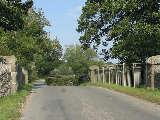
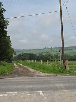
The walk starts in the town and heads north, crossing the old stone Lugg Bridge over the river. You can then follow footpaths east, passing the waterfall and weir on the Lugg. At Middlemoor you pick up a pleasant country lane and follow it east with nice views of the rolling hills.
At Kinsham Cross you head south, crossing the river again at Rosser's Bridge. You then turn west to Broad Heath Common before a final riverside path takes you back into Presteigne.
Please scroll down for the full list of walks near and around Presteigne. The detailed maps below also show a range of footpaths, bridleways and cycle paths in the area.
Postcode
LD8 2BB - Please note: Postcode may be approximate for some rural locationsPresteigne Ordnance Survey Map  - view and print off detailed OS map
Presteigne Open Street Map  - view and print off detailed map
*New* - Walks and Cycle Routes Near Me Map - Waymarked Routes and Mountain Bike Trails>>
Presteigne OS Map  - Mobile GPS OS Map with Location tracking
Presteigne Open Street Map  - Mobile GPS Map with Location tracking
Walks near Presteigne
- Mortimer Trail - This exceptionally lovely walk takes you through the beautiful Shropshire and Herefordshire countryside, from Ludlow to Kington.
The walk begins at the splendid, medieval Ludlow Castle in Shropshire and heads towards Aymestrey, crossing the River Teme before passing through Mortimer Forest, Haye Park Wood and Deer Park - Croft Ambrey - Climb to this Iron Age Hill Fort and enjoy great views over the Herefordshire countryside on this circular walk
- Bircher Common - Explore this area of lowland heath on this pleasant walk near Leominster
- High Vinnalls - Climb to this wonderful viewpoint on this circular walk in Mortimer Forest in Ludlow
- Croft Castle - This walk explores the grounds and gardens of the National Trust's Croft Castle near Leominster and Ludlow in Herefordshire.
- Kington - This Herefordshire based market town lies very close to the Welsh border
- Hergest Ridge - Cross the Hergest Ridge on this splendid walk on the England Wales border
- Black and White Village Trail - This splendid circular walking trail visits a series of lovely Herefordshire towns and villages.
- Shobdon - This short circular walk takes you around the pretty Herefordshire village of Shobdon.
- Tenbury Wells - This circular walk around the town visits some of the local highlights including the River Teme and Kyrewood
- Hay on Wye - This circuit around Hay on Wye takes you into the Brecon Beacons National Park on the Offa's Dyke Path
- Circular Walk around Ludlow - Visit Ludlow Castle, Whitcliffe Common and the River Teme on this walk around one of England's most attractive towns.
The walk starts at the imposing Ludlow Castle, just a short distance from the train station - Radnor Forest Ride - A long distance shared walking and cycle path that runs from Llanfair Waterdine on the English-Welsh border to the Brecon Beacons Visitor Centre
- Knighton - This border town in Powys is surrounded by the gorgeous countryside of the River Teme valley
- Aymestrey Riverside Inn Walk - This circular walk from the Riverside Inn in Aymestrey takes you to the nearby Croft Ambrey hill fort.
Pubs/Cafes
The Royal Oak can be found on the High Street at postcode LD8 2BB. The pub dates back to 1823 and serves good quality dishes. There is also a patio garden to sit out in on warmer days.
Dog Walking
The country trails make for a nice dog walk and the Royal Oak mentioned above is also dog friendly.
Further Information and Other Local Ideas
The long distance Mortimer Trail can be picked up just to the south of the town around Wapley Hill Fort Walk. The waymarked footpath can be used to further explore the area. Following it east would take you to Shobdon Hill Wood and the National Trust's Croft Ambrey Hill Fort in Herefordshire. The castle is surrounded by beautiful parkland and gardens with great views from the high points.
To the west you can pick up the epic Offa's Dyke Path and follow it north to Knighton and the impressive Knucklas Viaduct or south to Kington. Here you can explore the wonderful Hergest Ridge and pick up the Black and White Village Trail.


