Radstock Walks
![]()
![]() This Somerset based town is located on the northern slopes of the Mendip Hills and also close to the Cotswolds Hills AONB. There's nice walks through the Wellow Valley and easy rail trails along disused railway lines to try.
This Somerset based town is located on the northern slopes of the Mendip Hills and also close to the Cotswolds Hills AONB. There's nice walks through the Wellow Valley and easy rail trails along disused railway lines to try.
This walk from the town follows an old railway line along the Wellow Brook to the nearby village of Wellow. You'll pass a number of pretty brookside villages and a noteworthy ancient site at Stony Littleton.
The walk starts from West Hill Gardens and heads east past the old church to the eastern side of the town. Here you can pick up the shared cycling and walking trail and follow it east past Tyning, Lower Writhlington, Shoscombe and Stony Littleton where you will pass an ancient Long Barrow to the south of the brook. Shortly after you come into the little village of Wellow.
Postcode
BA3 3RR - Please note: Postcode may be approximate for some rural locationsRadstock Ordnance Survey Map  - view and print off detailed OS map
Radstock Open Street Map  - view and print off detailed map
*New* - Walks and Cycle Routes Near Me Map - Waymarked Routes and Mountain Bike Trails>>
Radstock OS Map  - Mobile GPS OS Map with Location tracking
Radstock Open Street Map  - Mobile GPS Map with Location tracking
Walks near Radstock
- Midsomer Norton - This Somerset based town is located near the Mendip Hills where there are plenty of opportunites for walkers
- Limestone Link - Starting at Cold Ashton in St Catherine's Valley, Gloucestershire follow the Limestone Link from the Cotswolds to the Mendip Hills in Somerset.
The walk first heads south towards Batheaston where you join the River Avon and the Kennet and Avon Canal for a lovely waterside stretch to Monkton Coombe - Greyfield Woods - These pretty woods near the village of High Littleton have some nice woodland trails to try
- Chew Valley Lake - This walk follows the delightful nature trail which runs along the eastern side of this large lake in Chew Stoke
- Three Peaks Walk - This is a fairly hilly circular route taking you through some of the most peaceful and attractive countryside in Somerset.
The walk starts and finishes in the pretty village of Chew Magna and follows the path to Pensford and then back via Clutton.
You will climb Knowle Hill, Maes Knoll, and Blackberry Hill (three peaks) while enjoying excellent views of the Mendip Hills, Dundry Hill and the surrounding Chew Valley countryside - Mells River Walk - Enjoy an easy riverside stroll on this walk from the village of Mells to Frome in Somerset.
The pretty village is noted for several interesting old buildings including the 16th-century Mells Manor and the Talbot Inn which dates from the 15th century and is Grade II listed. The fine inn was voted Sunday Times Hotel of the Year in 2013.
Starting from Mells you follow the river east through the Wadbury Valley to Great Elm, passing the Old Iron Works on the way - Shepton Mallet - Visit the Charlton viaduct and the village of Doulting on this circular walk in the Somerset town of Shepton Mallet.
Just to the north of the town you can pick up the East Mendip Way on Barren Down - Frome - The Somerset town of Frome has some lovely trails to follow through the surrounding countryside
- Heaven's Gate Longleat - Enjoy wonderful views over the Longleat Estate and the surrounding Wiltshire countryside on this short walk near Warminster
- Trowbridge Park and River Walk - A short circular walk through Trowbridge Park and along the River Biss.
The walk starts in Trowbridge Park, just to the east of the train station - Bath Canal Walk - This is a popular walk along the Kennet and Avon Canal from Bath to Bradford on Avon
- Bath Skyline Walk - Enjoy wonderful views of the city of Bath on this popular circular walk
- Norton St Philip - This charming Somerset village includes a historic church and a notable ancient pub which dates back to the 14th century
- Paulton - This former coal mining village is located north of the Mendip Hills in Somerset
- Wellow Brook Walk - This pretty Somerset based village is located just a few miles south of the city of Bath.
Pubs/Cafes
The Railway Hotel is a good choice for post walk refreshment. You can find them on Welton Road at postcode BA3 3RR for your sat navs.
Dog Walking
The waterside trails is a nice one to do with your dog. The Railway mentioned above is also dog friendly.
Further Information and Other Local Ideas
Just to the west there's the neighbouring town of Midsomer Norton where there's nice trails along the River Somer in the town centre and a historic 17th century priory. You can reach the town by following the Five Arches Greenway west from Radstock. The greenway is a shared cycling and walking trail along a disused railway line.
To the north there's more waterside paths along the Cam Brook around Dunkerton and Carlingcott. The waymarked Limestone Link can be picked up in this area and used to explore the area further.
In the nearby village of Clutton you can join with the Three Peaks Walk and explore the beautiful Chew Valley. Heading west along the trail will take you to the popular Chew Valley Lake. The pretty Litton Reservoir is also located in this area.
To the east there's the worthy village of Norton St Philip where you'll find a historic 14th century pub which claims to be the oldest in the country.
For more walking ideas in the area see the Somerset Walks page.
Photos
Waterfall near St. Nicholas Church, Radstock. The waterfall was created to form a bathing place for the Radstock miners and was popular in the early years of the 20th Century.
Site former Radstock Stations, 2006. View northward from the A367 Wells Road, in the centre of town where the two stations used to be, side by side. Nearest was the ex-GWR (Bristol, Radstock & Frome line) - Frome to the left (closed 2/11/59, goods 15/6/64). Just beyond was the Somerset & Dorset station ('Radstock North' from 9/49) on the S&D Bath (to right) - Evercreech Junction - Templecombe - Bournemouth West main line (closed 7/3/66)
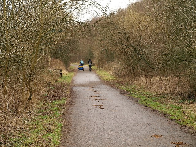
NCN cyclepath 24. The cyclepath follows the Somerset & Dorset Railway line along the valley of the Wellow Brook. Here it approaches the site of Writhlington colliery which is now the Writhlington Site of Special Scientific Interest. The site includes 3,000 tons of Upper Carboniferous spoil from which more than 1,400 insect fossil specimens have been recovered.
Radstock War Memorial and Miners' Memorial Garden. The Radstock War Memorial in its new location as part of the Miners' Memorial Garden. Former Kilmersdon Pit Wheel in background.
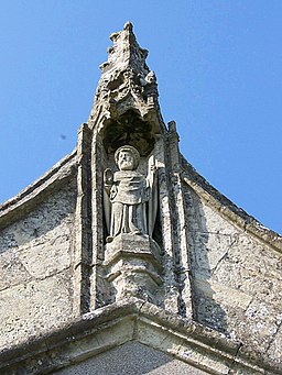
Statue, The Church of St Julian the Hospitaller, Wellow. Wellow is only one of seven churches in England dedicated to the patron of all wayfarers. He is better supported in Europe and the Middle East, with stained glass at both Chartres and Rouen Cathedrals, but is mentioned in the Prologue of Chaucer's Canterbury Tales. There are two versions of his story, agreeing in general apart from the reason for his acts of charity only being penitence for murder, the other (with his equally devoted wife) the result of a vision on his marriage night. Dedicated in the 9th century, the story was first quoted by St Antonine in circa 387AD. However, many later writings claim the former to be entirely mythical, since he has no fixed date, no country of origin, nor tomb or record of burial, while the latter is usually a joint dedication with that of his wife, Bassilissa.


