River Tyne Trail
![]()
![]() This waymarked long distance trail runs from the coast at Tynemouth to the source of the Tyne at Tyne Head, just south of Garrigill in the North Pennines.
This waymarked long distance trail runs from the coast at Tynemouth to the source of the Tyne at Tyne Head, just south of Garrigill in the North Pennines.
The route runs for just under 80 miles, exposing you to the wonderful scenery of the North Pennines AONB.
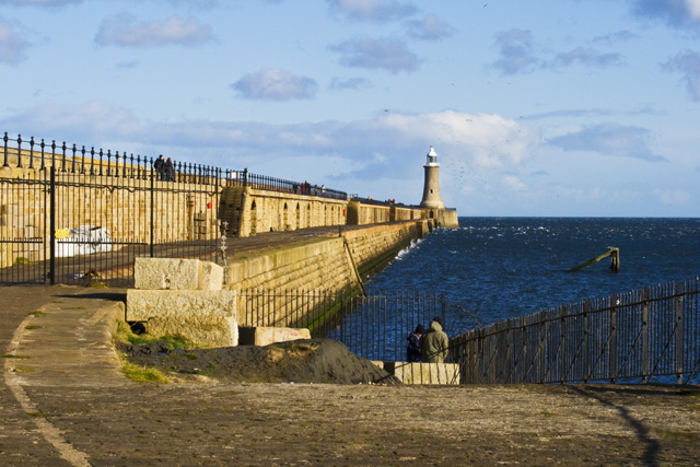
The trail starts off at the mouth of the river at Tynemouth where there's a splendid ruined castle and priory to see. You then head east through Newcastle, Gateshead, Wylam and Hexham. This opening section runs along part of the Hadrian's Wall Path National Trail.
You continue west to Haltwhistle, passing Haydon Bridge and the noteworthy Allen Banks and Staward Gorge. This National Trust owned area is worthy of a detour with its picturesque wooded gorge.
At Haltwhistle you run along the South Tyne Trail which will take you south to the finish point at Tyne Head. The shared cycling and walking route runs along a disused railway line, passing Slaggyford, Alston and Garrigill on the way.
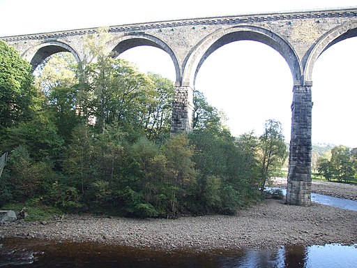
This final section passes the impressive Lambley Viaduct and the photogenic Ashgill Force waterfall as well.
You'll also pick up part of the Pennine Way in this area.
River Tyne Trail Ordnance Survey Map  - view and print off detailed OS map
River Tyne Trail Open Street Map  - view and print off detailed map
River Tyne Trail OS Map  - Mobile GPS OS Map with Location tracking
River Tyne Trail Open Street Map  - Mobile GPS Map with Location tracking
Pubs/Cafes
Near the end of the route you could enjoy some well earned rest and refreshment at The George & Dragon Inn in the village of Garrigill. The historic building dates back to 1611 with the pub opening in the early 1800s. They serve good quality home cooked food and have a good selection of ales. Inside there's a cosy interior with flagstone floors and wood burners. There are also picnic tables outside where you can relax with a lovely view of the village on warmer days.
In 2023 the pub underwent an extensive restoration project.
You can find the inn at postcode CA9 3DS for your sat navs.
Cycle Routes and Walking Routes Nearby
Photos
South Tyne near Lambley Viaduct. The 13 arch Lambley viaduct was constructed over the River South Tyne in 1852 to complete the Alston Line between Haltwhistle in Northumberland and Alston in Cumbria. The line closed in May 1976. The trackbed is now a walking trail, the South Tyne Trail.


