Rockcliffe to Kippford Walk
![]()
![]() This circular walk takes you from the National Trust's Rockcliffe to nearby Kippford in Dumfries and Galloway. It's a splendid stretch of coast with beaches, wildflowers and wonderful views across the Solway Firth. On the way look out for a variety of wading birds in the estuary and butterflies around the area's interesting flora.
This circular walk takes you from the National Trust's Rockcliffe to nearby Kippford in Dumfries and Galloway. It's a splendid stretch of coast with beaches, wildflowers and wonderful views across the Solway Firth. On the way look out for a variety of wading birds in the estuary and butterflies around the area's interesting flora.
The walk starts at the car park in Rockcliffe and first follows a section of the Jubilee Path to the 6th century Mote of Mark hill fort where there are fine views to enjoy. The route continues across Muckle Lands to Kippford village.
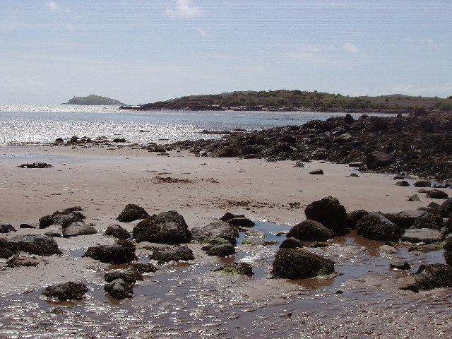
Here you can enjoy a section along the estuary of the River Urr with views across Rough Firth to the bird sanctuary at Rough Island.
To extend the walk you could head south on the Sandyhills To Kippford Coastal Walk. This will take you to the lovely Sandyhills Bay via the fine viewpoint at Castlehill Point and the Needles Natural Arch.
Postcode
DG5 4QQ - Please note: Postcode may be approximate for some rural locationsPlease click here for more information
Rockcliffe to Kippford Walk Ordnance Survey Map  - view and print off detailed OS map
Rockcliffe to Kippford Walk Open Street Map  - view and print off detailed map
*New* - Walks and Cycle Routes Near Me Map - Waymarked Routes and Mountain Bike Trails>>
Rockcliffe to Kippford Walk OS Map  - Mobile GPS OS Map with Location tracking
Rockcliffe to Kippford Walk Open Street Map  - Mobile GPS Map with Location tracking
Further Information and Other Local Ideas
To continue your exercise head north east to the expansive Dalbeattie Forest where there are miles of cycling and walking trails to enjoy.
Also not far is Threave Gardens and Carlingwark Loch, Loch Arthur and Mabie Forest.
Cycle Routes and Walking Routes Nearby
Photos
Port Donnell, Rockcliffe, near Dalbeattie. Beach on the estuary of Urr Water, taken from Rockcliffe village
Woodpecker Trail near Rockcliffe. The rocky headland between Rockcliffe and Kippford is owned by the National Trust for Scotland, who have established the "Woodpecker Trail" between the two villages.


