Mabie Forest Walks and Mtb - with trail maps
![]()
![]() This expansive forest in Dumfries has miles of good walking paths and several mountain bike trails to try.
This expansive forest in Dumfries has miles of good walking paths and several mountain bike trails to try.
This circular route follows a number of the cycling trails in the forest incuding the Rollercoaster, The Elevator and The Big Step. You can see more detail on the Open Street Map below. The cycle trails are marked in blue on the map.
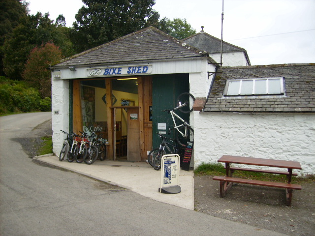
The route starts from the main parking area on the eastern side of the forest where there's also cycle hire nearby. On the way you'll pass Larch Hill, the Marthrown of Mabie, Marthrown Hill and Dalshinnie Loch. At the western side of the woods there's also Lochaber Loch where there's a waterside trail and a nature reserve. You can enjoy wonderful views down to the loch from the Red cycle trail.
For walkers there's several waymarked trails with wildlife sculptures, gardens and bluebells to see on the way. Also look out for wildlife including red squirrels, badgers, roe deer, foxes, woodland birds and bats.
Postcode
DG2 8HB - Please note: Postcode may be approximate for some rural locationsPlease click here for more information
Mabie Forest Ordnance Survey Map  - view and print off detailed OS map
Mabie Forest Open Street Map  - view and print off detailed map
*New* - Walks and Cycle Routes Near Me Map - Waymarked Routes and Mountain Bike Trails>>
Mabie Forest OS Map  - Mobile GPS OS Map with Location tracking
Mabie Forest Open Street Map  - Mobile GPS Map with Location tracking
Dog Walking
The woodland trails are ideal for dog walking so you'll probably see other owners on a fine weekend day.
Further Information and Other Local Ideas
To continue your cycling around Dumfries you could pick up the Dumfries to Annan, Dumfries to Castle Douglas, Dumfries to Gatehouse of Fleet or the Dumfries to Gretna cycle routes.
The new Kirkpatrick C2C also passes through Dumfries. The epic Coast to Coast route runs across the south of Scotland from Stranraer to Eyemouth.
Just to the south west there's the picturesque Loch Arthur to visit. The community includes a farm, a large garden, a creamery, a bakery, craft workshops and a thriving farm shop and cafe.
The RSPB site at Loch Ken is also to the west. There's lots of wildlife to see around this pretty site. Also to the west is Threave Gardens and Carlingwark Loch near Castle Douglas.
The Rockcliffe to Kippford Walk explores a beautiful area of National Trust owned land on the Rough Firth, a few miles south west of the forest. The area includes the 6th century Mote of Mark hillfort, lovely beaches and fine views across the Solway Firth. In this area you can also enjoy a cliff top walk to the peaceful Sandyhills Bay on the Sandyhills To Kippford Coastal Walk.
Dalbeattie Forest is not too far and has some similar trails. There's a notable mtb trail across a series of granite slabs to try here as well.
Head north and there's similar trails around the Ae Forest where you can also visit Loch Ettrick. The long distance Romans and Reivers Route starts in the forest. This 52 mile route follows the old Roman Roads to Hawick in the Scottish Borders. Following the trail north east will take you to Moffat where you can enjoy a riverside walk along the River Annan on the Annadale Way.
Also near here is the Crichope Linn waterfall at Gatelawbridge. Here you'll find a wooded red sandstone gorge with interesting rock formations, carvings and a pretty waterfall. Just to the north west of the falls there's the 17th century Drumlanrig Castle. The castle is surrounded by extensive grounds with several waymarked walking paths and some challenging mountain bike trails to try.
To the east there's Lochmaben where you can enjoy a lovely circular trail around Castle Loch. There's also the remains of the 12th century Lochmaben Castle to see here.
Cycle Routes and Walking Routes Nearby
Photos
Mabie Forest - The Burn Splash Looking back to the 'Burn Splash' on the Red Cycle trail in the forest. The splash is close to the end of the Descender Bender and Stans Pond section of singletrack. For anyone doing this trail for maximum excitement you can hit this one at speed so expect a large grin on your face afterwards.
The Roundhouse. The roundhouse at Marthrown was built using traditional methods - wooden pegs rather than nails and hemp rope. This is one of the few roundhouses that you are able to stay in. The fire in the centre warms the roundhouse, there is no chimney or vent - the smoke filters through the thatch.
Lochaber Loch. A small but beautiful Loch taken from a viewpoint on the Red Cycle trail at the start of the contour climb
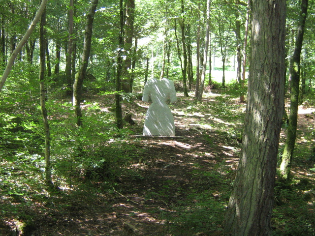
The Ghost Stane. This sculpture is near the start of the Red Cycle trial in the forest and is one of 7 sculptures across south and central Scotland on the world famous 7Stanes XC Mountain Bike courses. Situated in the 'misty glade' - a beech wooded area with a small stream - this stane is made from white marble. The 2.25 ton sculpture appears to be standing by itself. Its surface is engraved with a local lace pattern.


