Rosedale Abbey and Valley Walk
![]()
![]() This circular walk explores Rosedale, a beautiful valley in the middle of the North York Moors. It's a fantastic area for walking with wonderful scenery in a peaceful, unspoilt environment.
This circular walk explores Rosedale, a beautiful valley in the middle of the North York Moors. It's a fantastic area for walking with wonderful scenery in a peaceful, unspoilt environment.
The walk starts in the delightful village of Rosedale Abbey. It's a lovely place with old stone houses, a village green and the ruins of the former Cistercian Priory which once stood on the site. The walk then follows good footpaths up towards North Dale before a woodland section through the Knottside Plantation. You continue across the moors, passing a series of impressive industrial ruins from the mining period of the area. The views across the moors are magnificent as you climb to a height of over 1300 feet.
The return leg sees you descend past a series of farms and the village of Thorngill, before returning to Rosedale Abbey.
To continue your walking in the area head west and try the popular Farndale Daffodil Walk. There's nice waterside paths along the River Dover with lots of pretty daffodils to see in spring. Rosedale also includes Blakey Ridge, where there's more great views and the lovely Lion Inn pub.
The long distance Lyke Wake Walk runs just to the north of Rosedale Moor. It's a great way of exploring the North York Moors on foot, taking you across the nearby Danby Moor and Glaisdale Moor.
Just to the south is the lovely village of Hutton-le-Hole where you can try our circular walk to Lastingham and Spaunton.
Rosedale Ordnance Survey Map  - view and print off detailed OS map
Rosedale Open Street Map  - view and print off detailed map
Rosedale OS Map  - Mobile GPS OS Map with Location tracking
Rosedale Open Street Map  - Mobile GPS Map with Location tracking
Pubs/Cafes
The Abbey Tea Rooms in Rosedale Abbey are a lovely place to stop for some refreshments. There's outdoor seating overlooking the village green if the weather is good. They serve Breakfasts, Lunches, a selection of Cakes and Scones and Afternoon Tea's. It's a friendly place which also includes a store for supplies. You can find the tea room at postcode YO18 8SA.
Just to the west of the route you can take a slight detour to visit the The Lion Inn. The elevated inn is one of the most significant pubs in the country and well worth some investigation. The historic pub dates from the 16th century and is located at the highest point on the North York Moors. It stands at an impressive elevation of 1,325 feet offering breathtaking views over the valleys of Rosedale and Farndale. There's a cosy interior with ancient fireplaces, low beamed ceilings and a good selection of ales. Outside there's a beer garden with terrific views, ideal for a warm summer day. The pub is also dog friendly. You can find the pub at postcode YO62 7LQ for your sat navs.
Further Information and Other Local Ideas
Just to the south there's Rosedale Chimney Bank where you can explore the wonderful old kilns at Bank Top. There's a car park, information board and some fantastic photo opportunities in this historically fascinating area. From near the car park here you can also pick up the Rosedale Railway Walk. This will take you along the elevated Mineral Railway, visiting some of the heritage mines on the way.
Also to the south you can pick up the circular Lastingham Walk and climb across Spaunton Moor to the Ana Cross viewpoint. The wayside cross marks a medieval route way across the moor between Lastingham and the site of Rosedale Priory. The current cross dates from 1949 with the original moved to the 11th century St Mary's church in Lastingham village.
For more walks in the area see the North York Moors Walks page.
Cycle Routes and Walking Routes Nearby
Photos
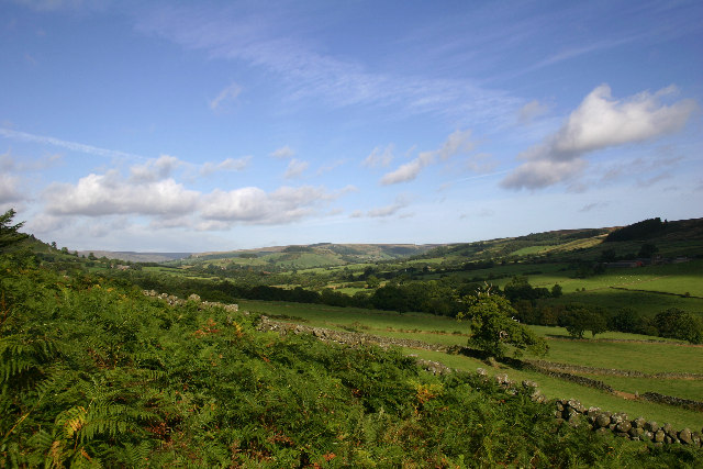
The view towards Rosedale Abbey. Taken from the Chimney road at a completely different time of the year to my other photograph - what a difference a season makes!
Avenue of trees, Rosedale Abbey. South of the village, large shady trees line both sides of the road for some distance. They are mainly Horse Chestnut and Sycamore.
The remains of Rosedale Abbey. This column is all that remains of the abbey that gave the village its name.
Ruin in the Seven Valley, Rosedale. Just behind where this photo was taken from is a plaque to state that Rosedale glass works were in existence in this area in Elizabethan times. Maybe this is just a ruined sheep fold, but it would be interesting to know whether there is any connection between it and the old glass works.


