Silton Forest
![]()
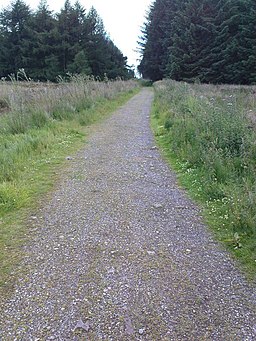
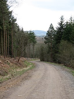
![]() Enjoy miles of mountain bike trails and footpaths in this large coniferous forest on the North York Moors. You can park on Moor Lane near to the village of Nether Silton to start your exercise. A cycling and walking trail then runs to the north of the forest along National Cycle Route 65. The tracks are great for mountain bikers with berms, humps, tight turns and drops.
Enjoy miles of mountain bike trails and footpaths in this large coniferous forest on the North York Moors. You can park on Moor Lane near to the village of Nether Silton to start your exercise. A cycling and walking trail then runs to the north of the forest along National Cycle Route 65. The tracks are great for mountain bikers with berms, humps, tight turns and drops.
The Cleveland Way runs along the eastern fringe of the forest so you can pick this up to continue your walk. Heading north will take you across Thimbleby Moor to Osmotherley where you can enjoy a waterside walk around Cod Beck Reservoir. The video below shows a walk to the forest from there.
Heading south will take you to Boltby Forest where there are more good trails to try.
Postcode
YO7 2JZ - Please note: Postcode may be approximate for some rural locationsSilton Forest Ordnance Survey Map  - view and print off detailed OS map
Silton Forest Open Street Map  - view and print off detailed map
*New* - Walks and Cycle Routes Near Me Map - Waymarked Routes and Mountain Bike Trails>>
Silton Forest OS Map  - Mobile GPS OS Map with Location tracking
Silton Forest Open Street Map  - Mobile GPS Map with Location tracking
Further Information and Other Local Ideas
A few miles to the south east you can visit the village of Hawnby and enjoy a climb to the splendid viewpoint at Hawnby Hill. There's wonderful views over Ryedale from this elevated spot.


