Blyth Walks
![]()
![]() This Northumberland based town has some nice coastal trails and paths along the River Blyth estuary to try.
This Northumberland based town has some nice coastal trails and paths along the River Blyth estuary to try.
This walk in the town takes you along Blyth Beach to the neighbouring village of Seaton Sluice.
The walk starts from the car park at South beach and follows a shared cycling and walking path along the coast. It's a flat trail running along the England Coast Path with nice views over the sea. Just west of the path you could pay a visit to the National Trust's Seaton Delaval Hall. The early 18th century Georgian mansion has an interesting history and is surrounded by some lovely gardens. It lies just to the west of Seaton Sluice.
You can continue your walking in the area by heading north west into the nearby Bedlington Country Park. There's more pleasant riverside trails, woodland, Humford Mill and lots of wildlife to see here. You can also pick up another cycling and walking path heading east along the Blyth Estuary here.
Blyth Ordnance Survey Map  - view and print off detailed OS map
Blyth Open Street Map  - view and print off detailed map
Blyth OS Map  - Mobile GPS OS Map with Location tracking
Blyth Open Street Map  - Mobile GPS Map with Location tracking
Walks near Blyth
- Bedlington Country Park - Enjoy nice woodland trails along the River Blyth in this country park in Bedlington, Northumberland.
The walk starts from the main car park at Bedlington Bridge - Whitley Bay to Tynemouth - Enjoy a coastal walk along the North East coast from Whitley Bay to Tynemouth
- South Shields - This coastal town in Tyne and Wear sits in a fine spot at the mouth of the River Tyne.
- Souter Lighthouse and Whitburn Coastal Park - Enjoy a coastal walk around the Souter Lighthouse, Whitburn Coastal Park and Lizard Point on the South Shields coast
- Druridge Bay Country Park - This beautiful country park on the Northumberland coast consists of three miles of beach and sand dunes, a large freshwater lake, peaceful woodland and meadows
- Wansbeck Riverside Country Park - Enjoy 275 acres of riverside parkland in this delightful country park near Ashington
- Queen Elizabeth II Country Park - Enjoy a short cycle or walk around the large lake in this pretty country park near Ashington
- Warkworth River Walk - Enjoy a nice stroll along the River Coquet on this easy circular walk in the popular village of Warkworth.
The walk starts from the ancient bridge of two arches which crosses the river, just north of the castle - Warkworth to Alnmouth - This is another splendid stretch of the Northumberland coast, with a historic castle, beautiful beaches, interesting villages and lovely bays to enjoy.
- Amble to Warkworth Walk - This walk explores the Northumberland Coast around the town of Amble before following the River Coquet to nearby Warkworth
- Plessey Woods Country Park - This pretty country park is situated on the River Blyth at Hartford Bridge, 5 miles south of Morpeth and north of Cramlington
- Humford Woods - These woods in Bedlington have nice trails to follow along the River Blyth
- Seaton Sluice - This pretty village sits in a lovely spot on the Northumberland coast near Whitley Bay and Blyth.
- Newbiggin By the Sea - This interesting town in Northumberland has some nice coastal trails along the local beach and bay
Photos
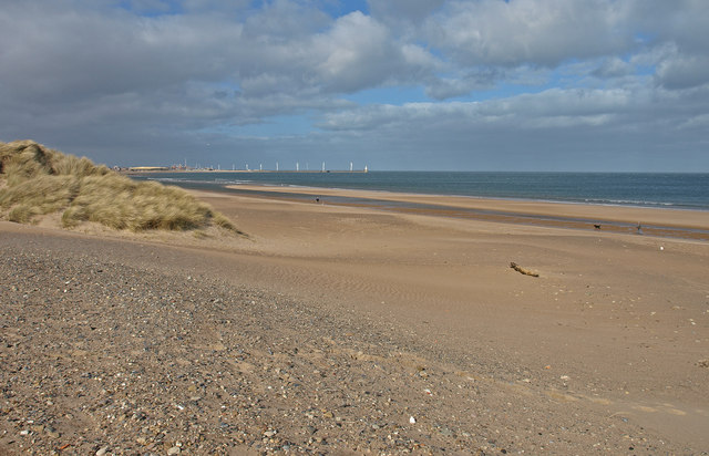
South Beach, Blyth. At this point, a stream emerges from underneath the sand dunes. The concrete blocks formed part of the wartime defences.
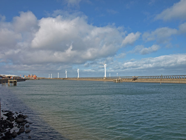
Old jetties at Battleship Wharf, Blyth. The wooden staithes at North Blyth were built in 1896 by the North Eastern Railway and these became the main shipping point for coal from the Ashington and Bedlington areas. Only the bottom levels of these massive structures now remain. The large container ship is still docked on the far shore


