South Brent Walks
![]()
![]() This large Devon based village is located on the southern edge of the Dartmoor National Park.
This large Devon based village is located on the southern edge of the Dartmoor National Park.
It's a fine place to start a walk with riverside trails, an old tramway and waymarked footpaths across the surrounding moorland.
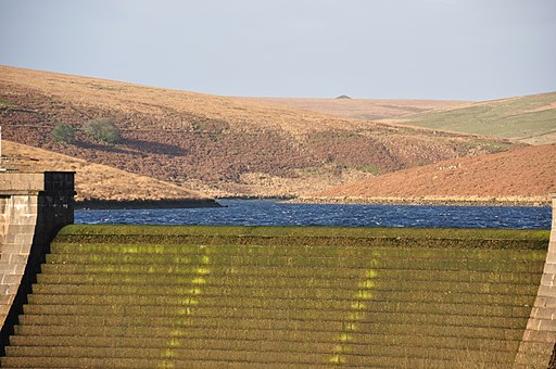
This circular walk from South Brent takes you north along the River Avon to visit the photogenic Avon Dam. You can follow waterside paths along the picturesque lake and then pick up the Two Moors Way at the Huntingdon Cross.
The waymarked long distance trail will take you along the old tramway to Quickbeam Hill and Ugborough Moor where there are some excellent views over the Avon Valley. The area is also covered in interesting ancient sites with hut circles, enclosures and barrows, all dating from the Bronze Age.
At Glasscombe Ball you head east to Owley Moor before following quiet country lanes back into South Brent.
Postcode
TQ10 9AA - Please note: Postcode may be approximate for some rural locationsSouth Brent Ordnance Survey Map  - view and print off detailed OS map
South Brent Open Street Map  - view and print off detailed map
South Brent OS Map  - Mobile GPS OS Map with Location tracking
South Brent Open Street Map  - Mobile GPS Map with Location tracking
Walks near South Brent
- Avon Dam - This walk takes you from Shipley Bridge to the Avon Dam reservoir along the River Avon
- Buckfastleigh and Buckfast Abbey - This short walk from the town of Buckfastleigh takes you through the countryside to Buckfast Abbey
- Abbot's Way - Travel from Buckfast Abbey to Tavistock Abbey on this long distance trail through the Dartmoor National Park
- Hembury Woods - This circular walk explores Hembury Castle Hill Fort and Hembury Woods in Buckfastleigh, Devon
- Dartmoor Way - This epic long distance circular walk takes you on a tour of the wonderful Dartmoor National Park.On the circular route you will pass Okehampton, Chagford, Moretonhampstead, Buckfastleigh, Princetown, Foggintor Quarry and Tavistock as you make your way around this circular route
- Ashburton - This walk in Ashburton takes you along the River Ashburn to some of the local woods to the north of the small town
- Venford Reservoir - This short circular walk takes you around the pretty Venford Reservoir on Dartmoor
- Holne Woods - This circular walk visits Devon's Holne Woods, near the village of Holne on the southeastern slopes of Dartmoor.
- Two Moors Way - Travel from Ivybridge to Lynmouth through the Dartmoor and Exmoor National Parks on this splendid walk through Devon and Somerset
- Loddiswell - This Devon based village has some lovely walking trails to follow through the Avon Valley
- Ivybridge - The town of Ivybridge is in a splendid spot for exploring the Dartmoor National Park on foot
Pubs/Cafes
The Pack Horse is a historic inn parts of which date back to medieval times. There's a charming old interior with a large inglenook fireplace and a garden outside for warmer days.
You can find them on Plymouth Rd with postcode TQ10 9BH for your sat navs. They are also dog friendly.
Photos
Fore Street, South Brent. The village includes a Norman Church and a Manor House dating from the 15th century.
Huntingdon Cross on the river Avon on southern Dartmoor, UK. It marks the route of the ancient track between Buckfast Abbey & Tavistock Abbey.
The Redlake Tramway on Ugborough Moor, on southern Dartmoor. The boundary stones separating Ugborough Moor from Harford Moor run parallel to the tramway here.


