South Foreland Lighthouse Walk
![]()
![]() This walk climbs to the Victorian South Foreland Lighthouse on the White Cliffs above St Margaret's. It's about a one mile walk from the town up to the lighthouse with great coastal views and a visit to the lovely Pines Garden on the way.
This walk climbs to the Victorian South Foreland Lighthouse on the White Cliffs above St Margaret's. It's about a one mile walk from the town up to the lighthouse with great coastal views and a visit to the lovely Pines Garden on the way.
The route starts at the public car park at St Margaret's Bay and follows a section of the South West Coast Path up to South Foreland. On the way you will pass the coastguard office on Bay Hill before following St Margaret's Road and Beach Road to the Pines Garden. The Gardens are well worth exploring with a waterfall and adjoining lake, a grass labyrinth and an organic kitchen garden with around 40 different species of fruit and vegetables. The site also includes the St. Margaret's Museum. The museum features changing displays about local history including St Margaret's during WW2, and one-time resident Noel Coward.
After leaving the Pines the path continues past the Grade II listed St Margaret's Windmill before coming to the lighthouse. The lighthouse was the first to display an electric light anywhere in the world. You can climb to the top of the structure and enjoy great views over to France. There's also a nice National Trust tea room for refreshments after your climb.
An alternative route is to park at the White Cliffs visitor centre and follow the White Cliffs Country Trails along the coast to the lighthouse. It's a slightly longer walk at 2 miles.
If you wish to extend your walk from the lighthouse you can continue west along the coast path and visit Dover Castle.
Postcode
CT15 5NA - Please note: Postcode may be approximate for some rural locationsPlease click here for more information
South Foreland Lighthouse Ordnance Survey Map  - view and print off detailed OS map
South Foreland Lighthouse Open Street Map  - view and print off detailed map
South Foreland Lighthouse OS Map  - Mobile GPS OS Map with Location tracking
South Foreland Lighthouse Open Street Map  - Mobile GPS Map with Location tracking
Explore the Area with Google Street View 
Further Information and Other Local Ideas
You could continue north on the St Margaret's Bay to Deal Walk and visit the historic Walmer Castle and Deal Castle.
For more walking ideas in the area see the Kent Walks page.
Cycle Routes and Walking Routes Nearby
Photos
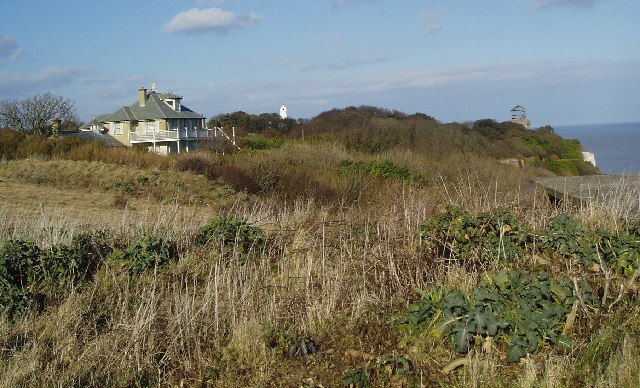
Coast House. A house, situated on the edge of the White Cliffs of Dover. In the distance, the head of a windmill can be seen, and to the right a disused lighthouse. To the immediate right, the roof of a World War 2 gun placement can be seen - though this may not last much longer as the cliffs are slowly being eroded and this was PRETTY close to the edge!
View to St Margaret's at Cliffe. View up the coast towards St Margaret's at Cliffe from on top of the lighthouse. A windmill can be seen in the middle distance.
White cliffs of Dover from Cap Gris Nez, France Cliffs East and West of Dover are visible about 35km away from France. The stretch in the photo extends at least from TR2436 to TR3745. The photographer grid reference is TR523136 as taken from a small scale OS Get-a-map which shows the outline of the French coast.


