Spen Valley Greenway Dewsbury
![]()
![]() This splendid cycling and walking route runs along a disused railway line from Dewsbury to Oakenshaw near Bradford. The path is well surfaced and entirely traffic free. As such it is ideal for families with young children or anyone looking for a nice easy ride or walk.
This splendid cycling and walking route runs along a disused railway line from Dewsbury to Oakenshaw near Bradford. The path is well surfaced and entirely traffic free. As such it is ideal for families with young children or anyone looking for a nice easy ride or walk.
You start off at Dewsbury, close to the train station, and follow the River Calder west to the start of the rail trail at the Ravensthorpe entry point. You then head north west through Iversedge and Cleckheaton, passing a wildlife reserve and a rolling golf course as you go. The trail is also lined with a number of sculptures such as Sally Matthew’s flock of Swaledale Sheep, constructed from recycled industrial scrap.
The trail comes to an end around Oakenshaw but you have the option of continuing along the National Cycle Network into Bradford which is only a few miles further north.
If you're on foot then you can link up with either the Kirklees Way or the Spen Way Heritage Trail at Oakenshaw.
Spen Valley Greenway Ordnance Survey Map  - view and print off detailed OS map
Spen Valley Greenway Open Street Map  - view and print off detailed map
*New* - Walks and Cycle Routes Near Me Map - Waymarked Routes and Mountain Bike Trails>>
Spen Valley Greenway OS Map  - Mobile GPS OS Map with Location tracking
Spen Valley Greenway Open Street Map  - Mobile GPS Map with Location tracking
Further Information and Other Local Ideas
In Dewsbury you could pay a visit to Dewsbury Country Park. There's good footpaths with orchards, wildflower meadows, ponds, lots of wildlife and views of the Spen Beck.
Cycle Routes and Walking Routes Nearby
Photos
Spen Valley Greenway, Dewsbury, near the entry point at the start. This Sustrans cycleway, which extends from the canal near Dewsbury to Oakenshaw, with a projected extension through the Transperience site to Bradford, has been a great success. The main reason is that, although it appears semi-rural with plenty of trees around, it passes a great many houses such as the ones on the left. It is also close to the centres of Heckmondwike, Liversedge and Cleckheaton. Like many cycleways, it is on the bed of a disused railway.
'Swaledale Flock', Liversedge. This trailside sculpture represents a complete flock of eleven sheep.
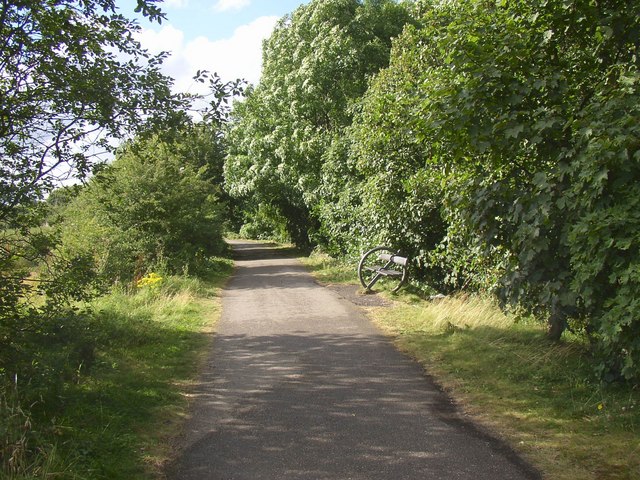
Seat at Cleckheaton. This is the section between the bridge over the M62 and the one over the A58. The area to the right, between these two roads, is mature woodland although this is not indicated on the OS 1:25000 map. You can see one of several seats of this design on the cycleway - they are works of art on the theme of a wheel.
Building site at Moor End, Cleckheaton. Industry gives way to suburbia. The foreground was part of the gas works, and beyond Whitechapel Road, unseen in this view, the land was a tar works. The old houses are on Snelsins Road, and the view is from the Greenway.
Railway Bridges over Railway Street, Heckmondwike. The two parallel bridges were necessary because the station was just beyond them, and had an island platform. This arrangement probably reduced the overall width of the station and thus of the embankment that it is built on. The entrance to the station was up steps between the two bridges. The railway is now the Spen Valley Greenway, National Cycle Route 66. In the foreground is one of the quirky signposts, and against the wall a monster sculpture.


