Steyning Walks
![]()
![]() This West Sussex based market town is in a fine location for exploring the South Downs National Park and the beautiful River Adur Valley.
This West Sussex based market town is in a fine location for exploring the South Downs National Park and the beautiful River Adur Valley.
The town is very pleasant for a stroll with a fine high street and a number of Tudor style half timbered houses and smart Georgian town houses to see.
This route from the town uses a section of the Downs Link and riverside footpaths to create a circular route through the area to the north east of Steyning. On the way you'll visit the River Adur and Bramber Castle and enjoy fine views of the countryside of the Adur Valley.
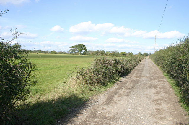
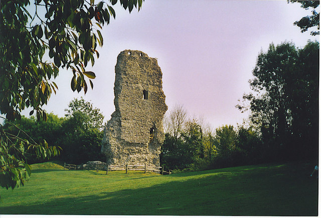
The walk starts on the eastern edge of the town where you can pick up the Downs Link and follow it north to Wyckham Farm before reaching the river at Stretham Manor. Here you pick up a riverside path which you can follow south to Upper Beeding and Bramber Castle. The ruined castle dates from the 11th century and also includes the more complete church which was built as part of the castle residences and buildings. It remains in use today.
From the castle it is a short walk north back to the start point at the eastern side of Steyning.
Steyning Ordnance Survey Map  - view and print off detailed OS map
Steyning Open Street Map  - view and print off detailed map
Steyning OS Map  - Mobile GPS OS Map with Location tracking
Steyning Open Street Map  - Mobile GPS Map with Location tracking
Pubs/Cafes
The White Horse is a good choice for some post walk refreshments in the town. This quintessential country pub and restaurant does very good food and also has a large outdoor terrace area for warmer days. You can find the pub on the High Street at a postcode of BN44 3YE for your sat navs.
Dog Walking
The river and country trails are ideal for a dog walk and the White Horse pub mentioned above is also dog friendly. There's also some good trails on the South Downs with good woodland areas to the west at Chanctonbury Ring.
Further Information and Other Local Ideas
Head south west from the town and you can explore the South Downs on the South Downs Way and Monarch's Way long distance trails. The area includes the hill fort at Cissbury Ring where there are splendid views towards Worthing on the south coast.
To the east there's one of the scenic highlights of the area at the Devils Dyke.
You could also continue south along the river to reach the coast at Shoreham by Sea.
Head north along the river and you could visit the neighbouring village of Henfield. The attractive settlement includes some historic buildings including a 13th century church and 17th century pub. The circular Henfield Walk explores the area, visiting the River Adur and the surrounding farmland.
Just to the south is the Lancing Ring Nature Reserve. The reserve is a great place for wildlife walks with splendid views over the Adur Valley from the high points.
For more walking ideas in the area see the South Downs Walks and Sussex Walks pages.
Cycle Routes and Walking Routes Nearby
Photos
Farmers Market Steyning. The monthly Farmers Market in the car park off the High Street on a crisp Saturday morning (January 2009)
Looking Down Into the Adur Valley. Viewed from the point where the Downs Link meets Wyckham Lane, the fields in the valley bottom still covered with frost.
River Adur. The buildings to the right belong to Stretham Manor, the original manor of Henfield, though this is the third house to have had this name, the others are on the western side of the former railway with the moat of the second that was occupied between the 1100 and c.1500 still extant. To the left is Stretham Bridge a former railway bridge built when the line from Shoreham to Horsham was constructed in 1861. It now carries the Downs Link, a long distance cycle path and bridleway. A former Roman ferry crossing was also located nearby probably to the south. Finally, the bush on the right marks the point where the footpath to Stretham Lane begins.


