Henfield Walks
![]()
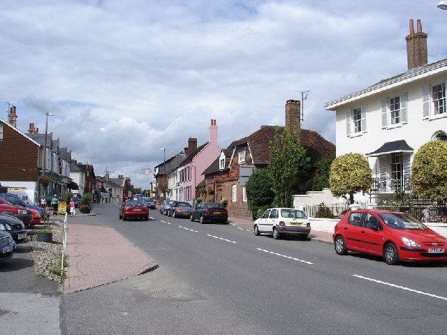
![]() This large village in West Sussex has some nice riverside and country trails to try. It's also close to the South Downs National Park which can be reached on foot on a handy waymarked trail runnning through the village. The village has an attractive centre with a historic 13th century church, a 17th century pub and the photogenic Cat House with its thatched roof.
This large village in West Sussex has some nice riverside and country trails to try. It's also close to the South Downs National Park which can be reached on foot on a handy waymarked trail runnning through the village. The village has an attractive centre with a historic 13th century church, a 17th century pub and the photogenic Cat House with its thatched roof.
This route from Henfield uses a section of the Downs Link and riverside trails to create a circular walk around the area.
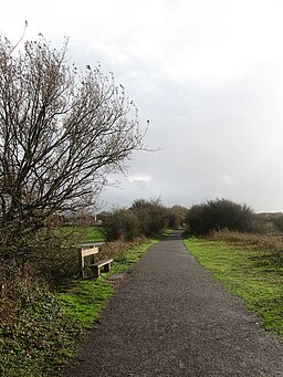
The route starts on the western side of the village where you can pick up the Downs Link. This shared cycling and walking trail can be followed north to Betley Bridge on the River Adur. You can then follow a pleasant riverside footpath south to Bineham Bridge and Stretham Manor. Here you can pick up the Downs Link again and follow the trail north back into Henfield.
Henfield Ordnance Survey Map  - view and print off detailed OS map
Henfield Open Street Map  - view and print off detailed map
Henfield OS Map  - Mobile GPS OS Map with Location tracking
Henfield Open Street Map  - Mobile GPS Map with Location tracking
Pubs/Cafes
Back in the village head to the historic Plough of Henfield which dates all the way back to the 17th century. They do very good food and also have a lovely garden area for warmer days. You can find them on the High Street at postcode BN5 9HP for your sat navs.
Dog Walking
The country and river trails are a nice one to do with your dog. The Downs Link path is shared with cyclists and horse riders so you will need to keep them under control on this section. The Plough mentioned above is also dog friendly with biscuit treats and bowls of water available.
Further Information and Other Local Ideas
Head south of the village and you can pick up the River Adur and Bramber Castle Walk. There's more nice trails and interesting villages around the historic 11th century castle. In this area you can also visit the attractive market town of Steyning. The neighbouring town is worth exploring with a fine high street and a number of Tudor style half timbered houses and smart Georgian town houses to see.
If you continue south along the river you will soon come to the coast at Shoreham by Sea.
If you continue north on the Downs Link then you can visit the lovely Southwater Country Park. There's good footpaths here around a series of pretty lakes with lots of wildlife to look out for on the way. Just south of here is the expansive Knepp Castle Estate. The estate is one of the walking highlights of the area with miles of trails, a 12th century castle and interesting wildlife including wild boar, nesting storks, horses and deer to look out for on the way.
For more walking ideas in the area see the Sussex Walks page.
Cycle Routes and Walking Routes Nearby
Photos
Meadows near the River Adur - south of Henfield. This is a view to the west from the disused railway track.
Bineham bridge over the river Adur. Walkers, horse riders and cyclists of a nervous disposition must be grateful that West Sussex CC have replaced the previous effort at a bridge by this superb structure. Bineham was known as Bredham or Bredman in the sixteenth century and in those days crossed two channels of the Adur.


