Walbury Hill
![]()
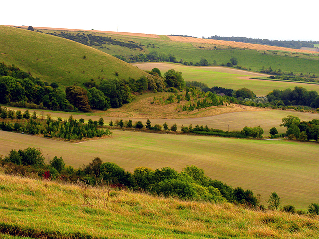
![]() This walk takes you to the highest point in Berkshire at Walbury Hill near Hungerford. The hill summit stands at 297 m (974 ft) and proffers wonderful views over the surrounding Berkshire countryside. At the summit you will also find the Iron Age Hill fort of Walbury Camp. The hill is also a popular climb for cyclists with a number of bridleways to follow across Inkpen and Walbury Hill.
This walk takes you to the highest point in Berkshire at Walbury Hill near Hungerford. The hill summit stands at 297 m (974 ft) and proffers wonderful views over the surrounding Berkshire countryside. At the summit you will also find the Iron Age Hill fort of Walbury Camp. The hill is also a popular climb for cyclists with a number of bridleways to follow across Inkpen and Walbury Hill.
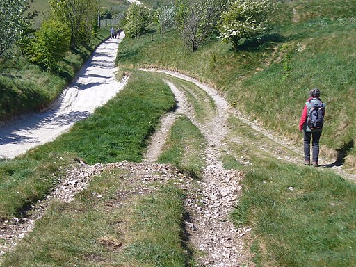
The walk starts from the Inkpen Beacon car park and follows the Wayfarer's Walk to the hill. The car park is located about half a mile from the hill so it is a short climb.
The Test Way long distance footpath also passes the hill so it's easy to extend this walk and climb to Combe Gibbet, Inkpen Beacon and Combe Wood. You could then return through Combe and turn it into a longer circular walk.
You could also pick up the Wayfarer's Walk and head south east along a wonderful ridge top path to the nearby Pilot Hill, the highest hill in Hampshire.
Postcode
RG17 9EL - Please note: Postcode may be approximate for some rural locationsWalbury Hill Ordnance Survey Map  - view and print off detailed OS map
Walbury Hill Open Street Map  - view and print off detailed map
*New* - Walks and Cycle Routes Near Me Map - Waymarked Routes and Mountain Bike Trails>>
Walbury Hill OS Map  - Mobile GPS OS Map with Location tracking
Walbury Hill Open Street Map  - Mobile GPS Map with Location tracking
Pubs/Cafes
For a longer circular walk you could try the Inkpen Walk. This starts from the 17th century Crown and Garter Pub in the little village which lies just north of the hill. The dog friendly pub has a decent sized car park and serves good quality pub food. You can find them at postcode RG17 9QR.
In the village you could also pay a vist to the noteworthy 13th century church and a rare Mediterranean crocus field, one of only two in the United Kingdom.
Further Information and Other Local Ideas
The little village of Chilton Foliat lies less than two miles to the north west of Hungerford. It's a lovely place for a stroll with several pretty thatched cottages, wildlife rich marshland and nice views of the River Kennet which runs through the settlement. Near here you can also visit Littlecote House, another of the area's highlights. The house dates from the mid 16th century and is surrounded by beautiful parkland and gardens. There's also a wonderful ancient Roman mosaic and the opportunity to enjoy afternoon tea at the historic house which is now run as an hotel.
Cycle Routes and Walking Routes Nearby
Photos
This is all that remains of the ramparts (single bank and ditch) that once protected the north side of the large iron-age hillfort that occupied the top of Walbury Hill. This hill is the highest part of the great chalk escarpment which overlooks the valley of the river Kennet, 3 miles away to the north (that is off to the left in the picture). At 974 feet ASL (279 metres) Walbury is said to be the highest chalk hill in England. Given the fort area covers all of 82 acres and the subsoil is chalk, it must have been a major feat to construct


