Warmington Walks
![]()
![]() Warmington is located in Northamptonshire near Oundle and Fotheringhay.
Warmington is located in Northamptonshire near Oundle and Fotheringhay.
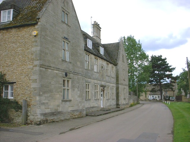
It's an attractive and historic place with a large 13th-century church, a fine watermill, a manor house and dovecote. Walkers can enjoy waymarked paths along the long distance Nene Way. This walk follows a section of the waymarked path north to visit Fotheringhay and Nassington. Along the way there are some fine countryside views and several historic buildings to see.
Please scroll down for the full list of walks near and around Warmington. The detailed maps below also show a range of footpaths, bridleways and cycle paths in the area.
Warmington Ordnance Survey Map  - view and print off detailed OS map
Warmington Open Street Map  - view and print off detailed map
Warmington OS Map  - Mobile GPS OS Map with Location tracking
Warmington Open Street Map  - Mobile GPS Map with Location tracking
Walks near Warmington
- Nassington - Nassington is located just north of Fotheringhay in Northamptonshire.
- Oundle River Nene Walk - A circular riverside walk around the Northamptonshire town of Oundle
- Fotheringhay - This pretty Northamptonshire village has some picturesque thatched cottages, an old castle motte and splendid views of the River Nene.
- Barnwell Country Park - Enjoy lovely waterside walking trails in this country park in Oundle, Northamptonshire
- Nene Way - Follow the River Nene through the beautiful Nene Valley on this fabulous walk through Cambridgeshire, Lincolnshire and Northamptonshire.
The long distance path runs for over 100 miles, passing Northampton, Wellingborough, Oundle, Peterborough and Wisbech.
There's much to enjoy on the way with rushing weirs, a series of historic villages and old mills - Wansford - This picturesque Cambridgeshire village sits in a nice location on the River Nene, near the border with Northamptonshire
- Peterborough - There's lots of fairly easy walks to enjoy around the cathedral city of Peterborough
- Ferry Meadows Country Park - This super country park in Peterborough has several pretty lakes with cycling and walking trails running alongside the water's edge
- Castor Hanglands - Explore the woodland, limestone, wetland grassland and scrub in this large National Nature Reserve near Peterborough
- Crown Lakes Country Park - Enjoy a stroll around the pretty lakes in this country park in Peterborough
- Bedford Purlieus National Nature Reserve - These splendid ancient woods near Peterborough have miles of woodland walking trails to try
- Kings Cliffe Railway Walk - This walk takes you along the old disused railway line in the Northamptonshire village of King's Cliffe.
- Fineshade Woods - Top Lodge in Fineshade Woods has several waymarked cycling and walking trails
- Blatherwycke Lake - This walk visits the little Northamptonshire village of Blatherwycke where you can enjoy a stroll along the pretty lake
- Barnack Hills And Holes - This walk explores the unique landscape of the Barnack Hills and Holes National Nature Reserve in the Cambridgeshire village of Barnack.
- Elton - This Cambridgeshire village is located a few miles west of Peterborough.
Pubs/Cafes
The Red Lion - Constructed from local stone around the turn of the 18th century, this well-loved, family-operated village pub features a quaint, old-world bar and a traditional inglenook fireplace, with a restaurant nearby. The bar extends to an additional lounge dining area. They offer homemade food daily, except on Mondays and Tuesdays. A spacious beer garden with Roman-style seating is available for guests. Patrons are recommended to call ahead to reserve a table, particularly on Sundays, due to the popularity of the food and potential changes in opening hours or days. Interestingly, the building that now houses the toilets once served as a fish and chip shop. The pub can be found on Peterborough Road at postcode PE8 6TN for sat navs. They are dog friendly.
Further Information and Other Local Ideas
Just to the north is Elton where you can visit another local historic highlight at Elton Hall. The part Gothic house, is surrounded by beautiful parkland and gardens. The hall is open to the public during the summer months and a lovely place for a stroll.
Photos
Warmington has an old water mill which functioned until the mid twentieth century, which was previously restored and used as a retail outlet for the ceramic tile company, Fired Earth.


