Wilts and Berks Canal
![]()
![]() Enjoy a stroll along this pleasant section of the Wilts and Berks Canal in Swindon. The walk starts in the town centre and follows the canal towpath to West Leaze Farm. On the way you'll pass the River Ray and the Rushey Platt Nature Reserve where you can look out for the water-vole. The canal runs on to Melksham via Wootton Bassett and Chippenham. Near Chippenham there is a section of the National Cycle Network running from Pewsham to Lacock Abbey. You can see this on the video below.
Enjoy a stroll along this pleasant section of the Wilts and Berks Canal in Swindon. The walk starts in the town centre and follows the canal towpath to West Leaze Farm. On the way you'll pass the River Ray and the Rushey Platt Nature Reserve where you can look out for the water-vole. The canal runs on to Melksham via Wootton Bassett and Chippenham. Near Chippenham there is a section of the National Cycle Network running from Pewsham to Lacock Abbey. You can see this on the video below.
To extend your walk you could try our Swindon Canal Circular Walk and visit the nearby Lawns Park and Queen's Park.
Wilts and Berks Canal Ordnance Survey Map  - view and print off detailed OS map
Wilts and Berks Canal Open Street Map  - view and print off detailed map
Wilts and Berks Canal OS Map  - Mobile GPS OS Map with Location tracking
Wilts and Berks Canal Open Street Map  - Mobile GPS Map with Location tracking
Pubs/Cafes
On the walk you could stop off at the Hall & Woodhouse Wichelstowe. The pub is situated in a lovely spot next to the canal and includes a fine interior with canal memorabilia decorating the pub. It even includes a canal boat cleverly nestled into the design of this modern pub. They serve good quality food and have a nice garden area next to the canal. You can find them at the southern end of the canal at Peglars Way with a postcode of SN1 7DA for your sat navs. There is a parking area and they are also dog friendly.
Cycle Routes and Walking Routes Nearby
Photos
Route of Wilts and Berks canal, Swindon. The canal fell into disuse about 100 years ago. This view is along the line of the route facing north-east. Ahead is Milton Road bridge hidden by the tree. The silver building is the David Murray John tower. The car at the right is in the back yard of a house in Curtis Street.
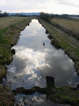
Viewed from the top of the old railway bridge, the surface of the canal is entirely covered in an undisturbed fine weed. This reach of the canal was restored in the late 1990s having been abandoned in 1914.
Near St Helen's View, Swindon The canal runs past an attractive residential area on the western edge of Old Town. Some of the highly priced properties there enjoy good views from their elevated position above the canal.
The River Ray near the Wilts and Berks canal, Swindon. The River Ray is one of two small rivers that drain into the Thames in the Cricklade area. The housing area to the left is fairly recent.
Near Wroughton. The canal carries on from here towards Wootton Bassett where the section with water in it ends.


