Wimborne Walks
![]()
![]() This circular walk around the Dorset town of Wimborne Minster uses part of the Stour Valley Way long distance trail to take you along the river and through the surrounding countryside.
This circular walk around the Dorset town of Wimborne Minster uses part of the Stour Valley Way long distance trail to take you along the river and through the surrounding countryside.
The route takes place on fairly flat paths and lasts for just over 3.5 miles.
The walk starts in the town centre, just west of the minster. The minster has a history stretching back over 1300 years and includes Norman and Gothic architecture. The Saxon church is notable for its chained library, and the tombs of King Ethelred and John Beaufort.
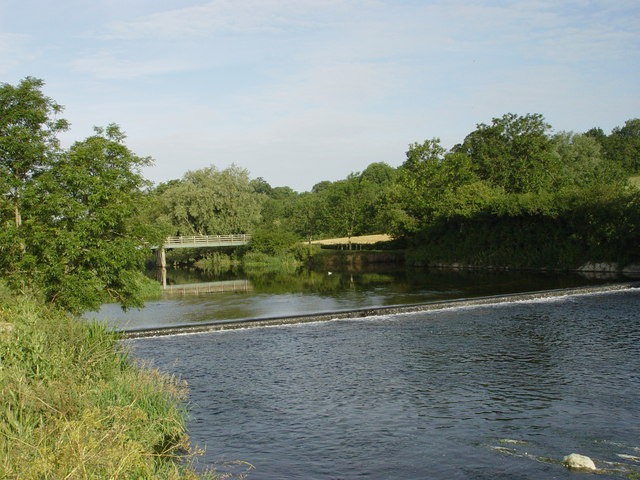
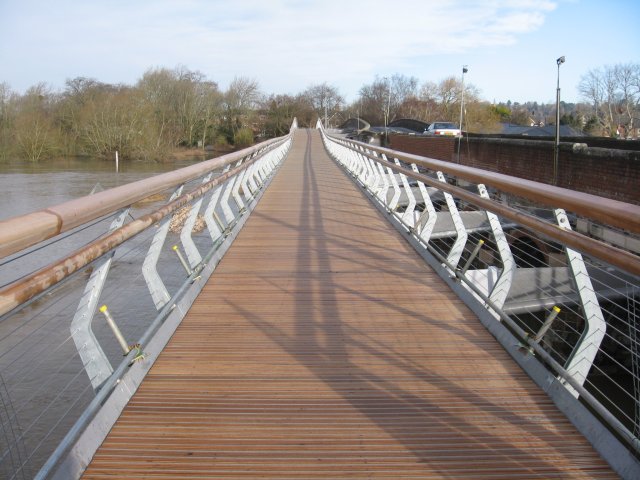
Head west from the town centre and you can pick up a waterside footpath along the River Stour heading towards Pamphill. After passing the weir cross the Eye Bridge and head south across Netherwood Mead. You then turn east past Merley Hall Farm towards Oakley, before turning north and following the River Allen back into the town. This section passes close to the lovely Deans Court, a beautiful private house and garden just a stone's throw from the centre of the town. There's pretty gardens and a vintage lifestyle shop and health-food cafe.
To extend your walking in the Wimborne area head west and visit the splendid Kingston Lacy. Here you'll find miles of walking trails and a climb to the Iron Age Hillfort at Badbury Rings. This will expose you to wonderful views over the Cranborne Chase AONB and the Wiltshire Downs.
Postcode
BH21 1LJ - Please note: Postcode may be approximate for some rural locationsWimborne Ordnance Survey Map  - view and print off detailed OS map
Wimborne Open Street Map  - view and print off detailed map
*New* - Walks and Cycle Routes Near Me Map - Waymarked Routes and Mountain Bike Trails>>
Wimborne OS Map  - Mobile GPS OS Map with Location tracking
Wimborne Open Street Map  - Mobile GPS Map with Location tracking
Walks near Wimborne
- Kingston Lacy - Explore the extensive parkland and gardens surrounding this lavish country mansion near Wimborne Minster in Dorset
- Badbury Rings - Climb this Iron Age hill fort and enjoy wonderful views across the Dorset countryside on this circular walk near Wimborne
- Stour Valley Way - This splendid walk takes you along the River Stour from Hengistbury Head on the Dorset south coast to Stourton in Wiltshire
- Holt Heath National Nature Reserve - Enjoy a walk through beautiful Dorset heathland in this delightful National Nature Reserve near Wimborne Minster
- Castleman Trailway - Travel from Ringwood to Poole along the disused Southampton to Dorchester railway line on this easy cycle and walking route
- Pamphill - This delightful Dorset settlement near Wimborne includes typical village features such as a picturesque green, a cricket pitch, a fine old church and quaint thatched cottages.
- Witchampton - This walk visits the historic Witchampton Mill before exploring the countryside surrounding the village of Witchampton near Wimborne in Dorset.
- Sturminster Marshall - This walk from the Dorset village of Sturminster Marshall explores the National Trust's White Mill before following a section of the Stour Valley Way to Kingston Lacy, Pamphill and Wimborne.
- Spetisbury - This pretty village in North Dorset has some lovely riverside walks and an ancient Iron Age Hillfort to visit
- Delph Woods - This woodland nature reserve is located near Corfe Mullen, Wimborne and Poole in Dorset.
- Canford Magna - This Dorset village is located just south of Wimborne near the River Stour.
Pubs/Cafes
For some refreshment in a historical setting head to The White Hart after your walk. The ancient pub dates all the way back to 1648 making it one of the oldest buildings in the town.
The inn was initially utilised as the Minster's stable before the local police used it as a holding area while they awaited the Assizes. Historically the Assizes court held periodic sessions in each county of England and Wales to handle civil and criminal cases. Assizes' civil and criminal jurisdictions were transferred to the High Court and the Crown Court, respectively, in 1972.
The pub serves a fine Sunday roast which you can enjoy in the lovely garden area.
You can find them at 6 The Corn Market with a postcode of BH21 1LJ for your sat navs.
Dog Walking
The country and river trails make for a fine dog walk. The White Hart is also dog friendly with water bowls available in the garden area.
Further Information and Other Local Ideas
Just west of the town there's the delightful village of Pamphill to visit. The picturesque settlement includes a village green, a cricket pitch, a fine old church and quaint thatched cottages. There's also the lovely Pamphill Dairy where there's a farm shop and cafe to visit.
Just to the east is the circularFerndown, Stour and Forest Trail. There's some nice riverside paths and a visit to the pretty Longham Lakes on this pleasant route.
A few miles to the north there's the pretty village of Witchampton where you can visit the 19th century watermill on the River Allen. It's a picturesque spot with a 15th century church and the nearby Crichel Park to visit.
For more walking ideas in the area see the Dorset Walks page.
Photos
Julian's Bridge, Wimborne Minster. Julian's Bridge takes the B3078 over the Dorset Stour into the town from the West. The bridge has more spans than expected to handle the extra width of the Stour when flooded. The bridge is narrow and care must be taken when wide vehicles are crossing. The fields to the West are the first parts of the floodplain to be flooded. Rabbits on the approach road at night are the first indication of flooding of the Stour.


