Winchcombe Way OS Map and GPX
![]()
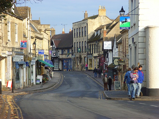
![]() This super figure of eight trail takes you on a tour of the stunning northern area of the Cotswolds. The route runs for a distance of just over 40 miles.
This super figure of eight trail takes you on a tour of the stunning northern area of the Cotswolds. The route runs for a distance of just over 40 miles.
The walk begins at the lovely town of Winchcombe and heads to Dumbleton via Gretton and Alderton. At Dumbleton you turn south over Dumbleton Hill and through Alstone toward Cleeve Hill and Common. Cleeve Hill is the highest point both of the Cotswolds hill range and in the county of Gloucestershire, at 1083 ft. Here you will also find Belas Knap neolithic chambered long barrow. A scheduled ancient monument in the care of English Heritage, it has been described as an 'outstanding example representing a group of long barrows commonly referred to as the Cotswold-Severn group'.
Shortly after Belas Knap you return to Winchcombe where the next section of the walk takes to Temple Guiting, passing through Guiting Wood on the way.
The path continues to Snowshill where you can explore the delightful Snowshill Manor.
Here you can view Charles Wade's collection of 'colour, craftsmanship and design' and enjoy the beautiful hillside gardens.
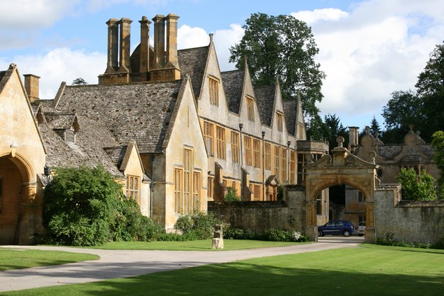
From Stanshill you continue through Buckland and Stanton before coming to another major route highlight at Stanway House. This splendid Jacobean manor house is right on the trail and open to the public. There are also beautiful gardens and a 300ft high fountain which is the tallest gravity fountain in the world.
The final section of the walk takes you back to Winchcombe, passing Didbrook and the National Trust owned Hailes Abbey with its 13th century ruins and excellent museum.
Please click here for more information
Winchcombe Way Ordnance Survey Map  - view and print off detailed OS map
Winchcombe Way Open Street Map  - view and print off detailed map
*New* - Walks and Cycle Routes Near Me Map - Waymarked Routes and Mountain Bike Trails>>
Winchcombe Way OS Map  - Mobile GPS OS Map with Location tracking
Winchcombe Way Open Street Map  - Mobile GPS Map with Location tracking
Pubs/Cafes
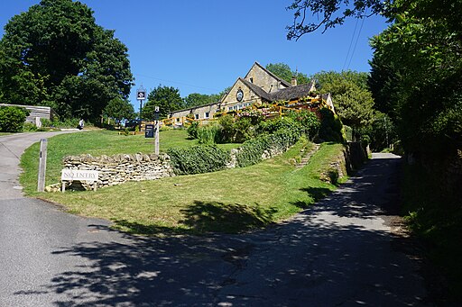
You could enjoy a pit stop in Stanton at the Mount Inn. The attractive 17th century pub sits in an elevated position on a mount at the end of the village. You can sit outside in the garden area and enjoy views across the Vale of Evesham towards the Malvern Hills & even the Black Welsh mountains beyond.
They have a great food menu and a good selection of drinks.
The ancient building has an interesting history having originally been a farmhouse. Sometime later it became a "cobbler shop", a tea room and then an off-licence.
You can find the inn on the High Street at postcode WR12 7NE for your sat navs. The pub is dog friendly.
Stanton is also well worth exploring with a number of ancient houses built from the honey coloured limestone quarried from the nearby Shenberrow Hill. It's generally considered to be one of the loveliest settlements in the Cotswolds.
Further Information and Other Local Ideas
The route links up with the epic Gloucestershire Way which explores the Forest of Dean before heading into Wales.
Cycle Routes and Walking Routes Nearby
Photos
Belas Knap Long Barrow, Ancient Monument. Belas Knap is one of the finest neolithic long barrows in Gloucestershire. Like all the other seventy or so known long barrows in the county, it is located on the limestone uplands of the Cotswolds. The long distance footpath The Cotswold Way passes this feature.
Stanway House is a wonderful place set in the Cotswolds and is sometimes used as a setting in films and period dramas. Stanway House, both exterior and interior, was the main filming location for the Father Brown episode "The Labyrinth of the Minotaur".
Elevation Profile


