Winchcombe to Belas Knap Walk
![]()
![]() This route makes use of the Cotswold Way and Winchcombe Way long distance trails to explore the countryside to the south of the town of Winchcombe. The walk runs for about 5 miles with some moderate climbs and splendid views from the high points. On the way you'll visit the fascinating Belas Knap neolithic, chambered long barrow, on Cleeve Hill.
This route makes use of the Cotswold Way and Winchcombe Way long distance trails to explore the countryside to the south of the town of Winchcombe. The walk runs for about 5 miles with some moderate climbs and splendid views from the high points. On the way you'll visit the fascinating Belas Knap neolithic, chambered long barrow, on Cleeve Hill.
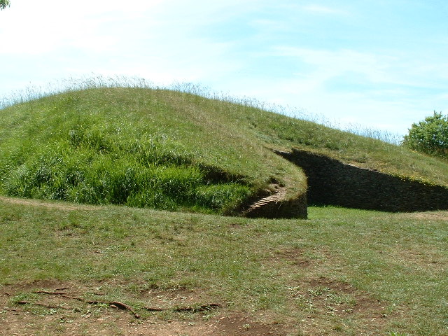
Starting in the town centre the route heads south along the Winchcombe Way to Wadfield Farm and the Humblebee Cottages. Shortly after you come to the historic site of Belas Knap. The fascinating scheduled ancient monument dates from around 3000 BC and includes a false entrance and independently accessible side chambers. Excavations in 1963 found the remains of 38 human skeletons, animal bones, flint implements and pottery dating from the Neolithic period (New Stone Age), circa 2000 BC.
After exploring the site the route picks up the Cotswold Way and heads north. You'll follow the popular waymarked trail through woodland and countryside before returning to the town.
The start of the walk passes very close to Sudeley Castle which is well worth a detour if you have time. You could explore the award-winning gardens and beautiful 1,200 acre estate surrounding this 15th century castle.
The walk passes close to Cleeve Common and Cleeve Hill, the highest point both of the Cotswolds and Gloucestershire.
Winchcombe to Belas Knap Walk Ordnance Survey Map  - view and print off detailed OS map
Winchcombe to Belas Knap Walk Open Street Map  - view and print off detailed map
*New* - Walks and Cycle Routes Near Me Map - Waymarked Routes and Mountain Bike Trails>>
Winchcombe to Belas Knap Walk OS Map  - Mobile GPS OS Map with Location tracking
Winchcombe to Belas Knap Walk Open Street Map  - Mobile GPS Map with Location tracking
Further Information and Other Local Ideas
Head a couple of miles north east of the town and you can visit one the area's historic highlights at Hailes Abbey. The 13th century abbey ruins are now under the care of English Heritage. Our circular walk visits the town from the abbey so could be started/finished in Winchcombe.
The Three Castles Path starts/finishes at the castle in the town. This historic long distance trail will take you to Windsor Castle, visiting the ruined Odiham Castle on the way.
The circular walk from Ashton Under Hill to the picture postcard village of Elmley Castle and the fine viewpoint at Bredon Hill lies just a few miles to the north.
For more walking ideas in the area see the Gloucestershire Walks and the Cotswolds Walks page.
Cycle Routes and Walking Routes Nearby
Photos
Sudeley castle was once the home of Katherine Parr, Henry VIII's sixth wife. After Henry's death Katherine married Edward Seymour and lived at Sudeley for a short time until her death from child birth in 1548. Her tomb is in St. Mary’s Church in the castle grounds.
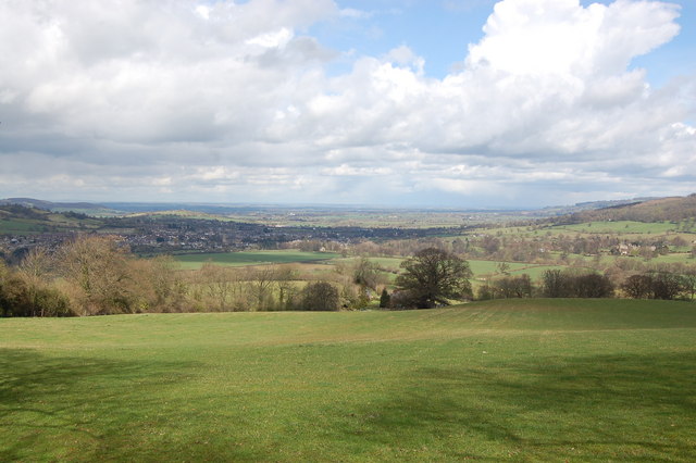
Pastureland near Wadfield Farm, south of Winchcombe. View looks northwards across sheep pasture towards the vale of Evesham. The town can be seen on the left with tower of St Peter's church standing prominent. To the right is Sudeley castle.
Belas Knap Long Barrow. Restored in 1928, 52 m long, 18 m wide at the north end. The remains of 30 people were found in the excavations. The name Belas Knap means Beacon Mound.


