Brown Moss Nature Reserve
![]()
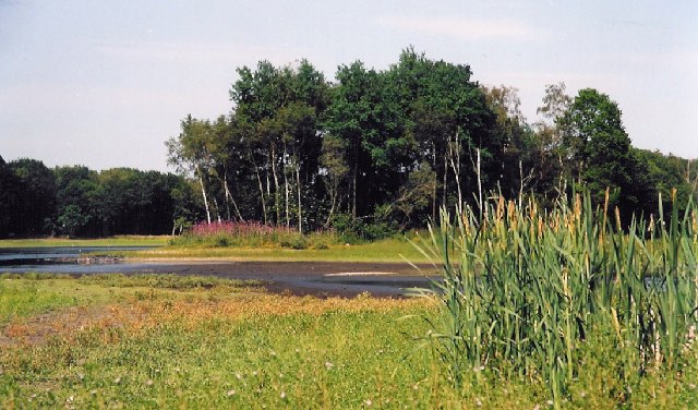
![]() Enjoy a series of walking trails in this delightful nature reserve near Whitchurch. The site is 77 acres and includes marshes, pools, heathland and woodland. It's great for bird watching with woodpeckers, jays, Canada goose, mallard and great crested grebe regular visitors. Look out for froglets, dragonflies and great crested newts around the wetland areas.
Enjoy a series of walking trails in this delightful nature reserve near Whitchurch. The site is 77 acres and includes marshes, pools, heathland and woodland. It's great for bird watching with woodpeckers, jays, Canada goose, mallard and great crested grebe regular visitors. Look out for froglets, dragonflies and great crested newts around the wetland areas.
Postcode
SY13 4BX - Please note: Postcode may be approximate for some rural locationsBrown Moss Nature Reserve Ordnance Survey Map  - view and print off detailed OS map
Brown Moss Nature Reserve Open Street Map  - view and print off detailed map
Brown Moss Nature Reserve OS Map  - Mobile GPS OS Map with Location tracking
Brown Moss Nature Reserve Open Street Map  - Mobile GPS Map with Location tracking
Further Information and Other Local Ideas
Just to the north there's Comber Mere. The 12th century abbey includes a large lake and bluebell woodland which is open to the public on certain open days. Near here you'll also find the worthy village of Wrenbury. The settlement is a conservation area with a number of historic properties including an early 16th century church overlooking the pretty village green. There's also a fine canalside pub with a lovely garden to visit.
For more walking ideas in the area see the Shropshire Walks page.


