Haystacks and Fleetwith Pike from Buttermere Circular Walk
![]()
![]() Although not one of the highest of the Lake District fells at (597 m, 1,958 ft), Haystacks was one of Alfred Wainright's favourites. So much so that he chose to have his ashes scattered near the summit.
Although not one of the highest of the Lake District fells at (597 m, 1,958 ft), Haystacks was one of Alfred Wainright's favourites. So much so that he chose to have his ashes scattered near the summit.
The walk begins at the car park at the south eastern end of Buttermere and starts by crossing Peggy's Bridge. You then cross Buttermere Fell, ascending to Scarth Gap and then to the summit. The view is magnificent with Gable Crag on Great Gable and the western panorama of Ennerdale Water and High Crag. Crummock Water and Buttermere are also visible.
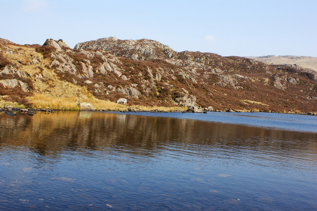
The walk then heads past the lovely Innominate Tarn, a popular beauty spot with an indented rocky shore and a line of tiny islets. Shortly after you come to Blackbeck Tarn, a long slender pool which overflows through a cleft in the crags. You could descend from here through Warnscale Bottom with views of Warnscale Beck and its series of pretty waterfalls.
However, this walk continues on to Fleetwith Pike before descending back to the car park via Fleetwith Edge.
If you'd like to continue your walking then a stroll around the nearby Ennerdale Forest and Buttermere Lake are always enjoyable.
Haystacks Ordnance Survey Map  - view and print off detailed OS map
Haystacks Open Street Map  - view and print off detailed map
*New* - Walks and Cycle Routes Near Me Map - Waymarked Routes and Mountain Bike Trails>>
Haystacks OS Map  - Mobile GPS OS Map with Location tracking
Haystacks Open Street Map  - Mobile GPS Map with Location tracking
Pubs/Cafes
The Fish Inn in Butteremere village is a lovely place to go for some post walk refreshment. The inn has an interesting history being one of the oldest inns in the Lake District. They do good food and there's a comfy lounge with sofas and a fireplace to relax in indoors. There's also seating outside with fabulous views of the surrounding fells. You can easily find it in the village at postcode CA13 9XA.
The Bridge Inn is also located right in the village. There's another fine garden area with one of the best views in England here.
Further Information and Other Local Ideas
Just to the east there's another fine climb to Fleetwith Pike. In this area you can also explore the Honister Pass Slate Mine. The historic site is notable as the last working slate mine in England and dates back to 1728. It's also a major Lake District tourist attraction with mine tours and the exhilirating Infinity Bridge where you can edge your way across a gorge 1,000 feet above sea level.
South east of Buttermere Lake there's the climb to Warnscale Bothy and Buttermere Infinity Pool. Here you'll find a wonderful old bothy tucked into the hillside and crystal clear pool great for wild swimming.
Cycle Routes and Walking Routes Nearby
Photos
Path into Warnscale Bottom. This is the start of an attractive approach up Haystacks, which can be seen in the background.
Innominate Tarn. View towards Pillar. The tarn is a popular beauty spot with an indented rocky shore and a line of tiny islets. It is significant as the location where Alfred Wainwright's ashes were scattered. He expressed this wish in 'A Pictorial Guide to the Lakeland Fells Volume 7: The Western Fells' and in his memoirs:
"All I ask for, at the end, is a last long resting place by the side of Innominate Tarn, on Haystacks, where the water gently laps the gravelly shore and the heather blooms and Pillar and Gable keep unfailing watch. A quiet place, a lonely place. I shall go to it, for the last time, and be carried: someone who knew me in life will take me and empty me out of a little box and leave me there alone. And if you, dear reader, should get a bit of grit in your boot as you are crossing Haystacks in the years to come, please treat it with respect. It might be me."
~ Alfred Wainwright - from "Memoirs of a Fellwalker" (1990)
Elevation Profile


