Worcester and Birmingham Canal
![]()
![]() Follow the Worcester and Birmingham Canal from the vibrant centre of Birmingham, through the green hills of Worcestershire, to the cathedral city of Worcester. After leaving Birmingham you enter the countryside and will encounter a series of locks including Tardebigge Locks. With 30 locks in about 2 miles, Tarddebigge is the longest in the country, and also one of the steepest.
Follow the Worcester and Birmingham Canal from the vibrant centre of Birmingham, through the green hills of Worcestershire, to the cathedral city of Worcester. After leaving Birmingham you enter the countryside and will encounter a series of locks including Tardebigge Locks. With 30 locks in about 2 miles, Tarddebigge is the longest in the country, and also one of the steepest.
This is a nice easy waterside walk, suitable for all walkers.
Highlights on the route include the chocolate factory at the pretty model village of Bournville. It's well worth a short detour from the towpath to explore the village with its historic buildings and pretty little park.
Around Droitwich Spa the canal links with the Droitwich Canal which will take you west through the town into the surrounding countryside.
Please click here for more information
Worcester and Birmingham Canal Ordnance Survey Map  - view and print off detailed OS map
Worcester and Birmingham Canal Open Street Map  - view and print off detailed map
Worcester and Birmingham Canal OS Map  - Mobile GPS OS Map with Location tracking
Worcester and Birmingham Canal Open Street Map  - Mobile GPS Map with Location tracking
Pubs/Cafes
The picturesque village of Alvechurch is a nice place for a stroll and a pit stop. The Weigh Bridge is right on the canal and includes a splendid garden area where you can sit outside and watch the boats go by on a summer day. They have a good menu and an excellent selection of ales as a CAMRA award winner. The pub can be found at Scarfield Hill with a postcode of B48 7SQ for your sat navs. They are also dog friendly if you have your canine friend with you. The historic village is also well worth exploring with a 13th century church and several medieval half-timbered buildings to see. You'll also pass the two Bittell Reservoirs and the popular Lickey Hills Country Park as you make your way through this area.
In Stoke Pound there's the canalside Queens Head. There's a charming interior including Victorian floor tiles with beaten copper and the natural textures of wood and stone. Outside there is an attractive landscaped garden with a tepee which can be booked for private parties. You can find them at postcode B60 3AU for your sat navs. The inn includes car parking and is also dog friendly.
Further Information and Other Local Ideas
For more walking ideas in the area see the Worcestershire Walks page.
Cycle Routes and Walking Routes Nearby
Photos
Lock No 1 on the canal. The first two locks on the Worcester and Birmingham canal are 14ft wide to allow river craft to enter Diglis Basin. It was considered too expensive to build broad locks so the other 56 locks on the canal were built to the narrow 7ft specification.
Canal and railway line. Looking southwest from Somerset Road. Pritchatts Road crosses the railway line and canal at the bridges in the distance. The canal was built to link the River Severn to Birmingham & the Black Country. The railway line originally formed the former Midland Railway's West Suburban Railway, opened in 3rd April 1876. The line was electrified in the 1970s to form the Cross City Line, and is heavily used. The passing train is a longer distance central trains service.
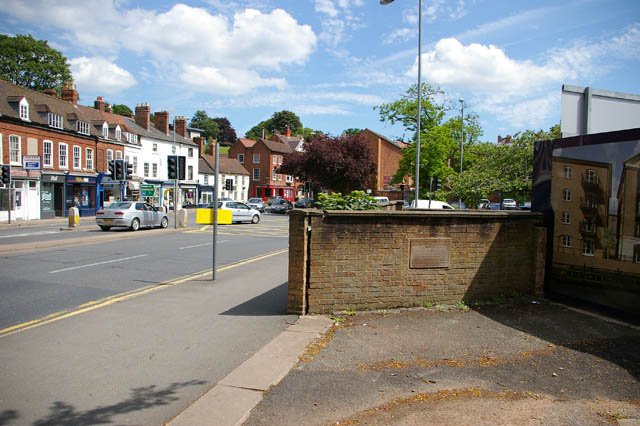
Near the site of Sidbury Gate. On the wall is a stone plaque commemorating the Battle of Worcester, the last battle of the English Civil War, fought on 3 September 1651. Near this spot, in the city wall, stood the Sidbury Gate, which was stormed by parliamentarian forces. The canal lies behind the wall.
Elevation Profile


