National Cycle Route 2
![]()
![]() This is the completed section of Sustrans National Cycle Route 2 running from Dover on the Kent coast to Dawlish on the Devon coast. When fully completed it will run all the way to St Austell on the Cornish coast.
This is the completed section of Sustrans National Cycle Route 2 running from Dover on the Kent coast to Dawlish on the Devon coast. When fully completed it will run all the way to St Austell on the Cornish coast.
On the way you're never far from the beautiful south coast passing along the splendid Jurassic Coast and visiting towns including Bournemouth, Poole, Brighton and Exeter and Plymouth.
Traffic free highlights on the route include the wonderful Exe Estuary Trail and the Lower Leas Coastal Park in Folkestone.
Scroll down for videos on the route and scroll to the bottom for the gpx file.
Cycle Routes on National Cycle Route 2
- Rye to Dover - This largely flat coastal ride takes you along the trail from Rye in East Sussex to Dover and its famous white cliffs.
You start in Rye and head to Camber where there is a lovely coastal stretch with views of Camber sands - Eastbourne to Rye - This coastal ride takes you along the trail from Eastbourne to Rye
- Brighton to Eastbourne - Starting at the pier in Brighton this ride takes you along the south coast to Newhaven and then inland through some lovely countryside to Eastbourne along the trail
- Littlehampton to Shoreham-By-Sea - This route follows the trail along the beautiful Sussex coast, from Littlehampton to Shoreham by Sea.
You start by following the River Arun passing Littlehampton marina before a short stretch along the coast with views of Littlehampton beaches - Bognor Regis to Littlehampton - This route follows the trail from Bognor Regis to Littlehampton
- Chichester to Bognor Regis - This is a nice, easy short route from Chichester to Bognor Regis which follows the trail and local cycle paths.
You start in the centre of Chichester and soon join a lovely canalside path along the Chichester Canal - Havant to Chichester - Follow NCN route 2 on this lovely short route along the south coast
- Portsea Island Explorer - A super cycle ride around Portsea Island in Portsmouth which links with the adjacent Hayling Billy Trail around Hayling Island
- Southampton to Portsmouth - Follow the trail between these two major Hampshire ports
- Brockenhurst to Burley - This route follows the trail from Brockenhurst to Burley
- Bournemouth to Ashurst New Forest - Starting in the south coast seaside town of Bournemouth travel east along the prom to Christchurch and then through the Dorchester to Wareham - Follow NCN route 2 on this lovely easy route through the Dorset countryside
- Axminster to Dorchester - Travel from Devon into Dorset following the trail.
The south coast is never far away as you travel through some lovely countryside on your way to the market town of Dorchester on the River Frome.The route takes you through many pretty Dorset villages including Little Bredy and Winterborne St Martin and has splendid views of the Dorset countryside and coast - Exmouth to Axminster - Follow the trail through Devon from Exmouth to Axminster
- Exmouth to Lyme Regis - Follow the trail through the Devon countryside from Exmouth to Lyme Regis
- Exmouth to Sidmouth - This short route takes you along NCN route 2 from Exmouth to Sidmouth
- Exeter to Exmouth - This easy route follows NCN route 2 from Exeter to Exmouth
- Exe Valley Ride - This lovely easy ride or walk follows the River Exe, the Exeter Canal and the trail from Exeter to Exminster.
Highlights include Exeter's attractive quay, views of the Exe esutaury and the Riverside Valley Park.
Please click here for more information on this route. - Exmouth to Budleigh Salterton Railway Path - This is a nice easy cycle or walk along the disused railway path running from Exmouth to Budleigh Salterton.
It runs along the trail through rolling countryside and woodland - Totnes to Ivybridge - Follow the trail through Dartmoor National Park from Totnes to Ivybridge
- Plymouth to Totnes - This beautiful ride along the trail , takes you through Dartmoor National Park and the South Devon AONB.
You start at the marina in Plymouth and follows the River Plym towards Longbridge - Exe Estuary Trail - This splendid, largely traffic free ride takes you around the beautiful Exe Estuary on the south Devon coast
National Cycle Route 2 Ordnance Survey Map  - view and print off detailed OS map
National Cycle Route 2 Open Street Map  - view and print off detailed map
National Cycle Route 2 OS Map  - Mobile GPS OS Map with Location tracking
National Cycle Route 2 Open Street Map  - Mobile GPS Map with Location tracking
Cycle Routes near National Cycle Route 2
- National Cycle Route 25 - National Route 25 is a signed Sustrans Cycle Path running from Longleat to Bournemouth on the south coast.
- National Cycle Route 22 - This Sustrans cycle route takes you from the outskirts of South London to Newport on the Isle of Wight.
Further Information and Other Local Ideas
In Bournemouth you can link up with National Cycle Route 25 which will take you from Dorset to Longleat House in Wiltshire.
The route links up with National Cycle Route 22 around Havant/Portsmouth. This will take you north through Hampshire, Surrey and the North Downs to Banstead near South London.
Photos
Cycle Route, Langstone, Hampshire "End of Cycle Route; Cyclists Dismount" says the sign. I wonder how many, having spotted a ship, went to investigate. At this point, the cycle route has just left the old trackbed of the Hayling Island Branch, and cyclists have to reach the island via Langstone Bridge.
Esplanade - Bognor. No sign of coastal erosion here. Quite the contrary. The railing were obviously intended to prevent falls down to the beach at one time. You can just see the hand rail of some steps, that led down to the beach at some time. Further along, the beach was nearly 1 metre above the level of the esplanade.
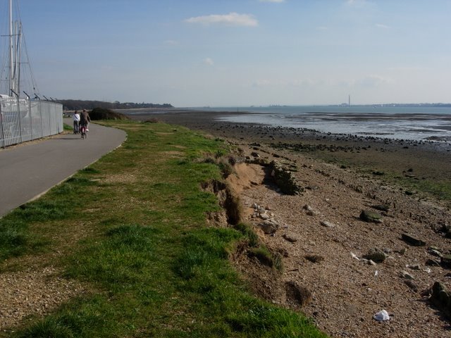
Weston Shore. At low tide a substantial area of mud and shingle is exposed, providing habitat for wading birds and bait diggers.


