Stover Cycle Path
![]()
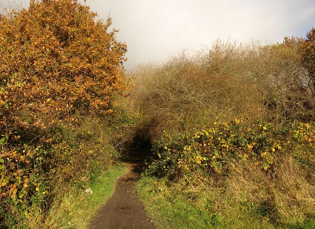
![]() This off road cycle trail runs between Bovey Tracey and Newton Abbot on National Cycle Route 28. The route runs for about 6 miles on a fairly flat path so it's a nice easy ride. On the way you'll pass through the lovely Stover Country Park where there's 114 acres of woodland, heathland, grassland and lakes.
This off road cycle trail runs between Bovey Tracey and Newton Abbot on National Cycle Route 28. The route runs for about 6 miles on a fairly flat path so it's a nice easy ride. On the way you'll pass through the lovely Stover Country Park where there's 114 acres of woodland, heathland, grassland and lakes.
The route starts in Bovey Tracey on the edge of the Dartmoor National Park. The trail then heads south east running parallel to the River Bovey and skirting the eastern edge of Stover Park.
You continue past Teigngrace where you run along the Stover Canal and the River Teign into Newton Abbot.
To extend your ride you can continue along route 28 on the Newton Abbot to Brixham Cycle Route.
Stover Cycle Path Ordnance Survey Map  - view and print off detailed OS map
Stover Cycle Path Open Street Map  - view and print off detailed map
Stover Cycle Path OS Map  - Mobile GPS OS Map with Location tracking
Stover Cycle Path Open Street Map  - Mobile GPS Map with Location tracking
Pubs/Cafes
The Bell Inn in Bovey Tracey is a great option for some refreshments. The friendly, cosy pub has a good menu and a very fine garden area to relax in on warmer days. You can find it at Town Hall Place with postcode TQ13 9AA for your sat navs.
Further Information and Other Local Ideas
In Newton Abbot you could pay a visit to Decoy Country Park. There's a Wildlife Discovery Centre, Nature Reserve and a watersports centre next to a pretty lake here.
At Bovey Tracey the route links up with the Wray Valley Trail. Another popular rail trail this one runs to Moretonhampstead via Lustleigh on a traffic free surfaced path.


