Bovey Tracey to Lustleigh Walk
![]()
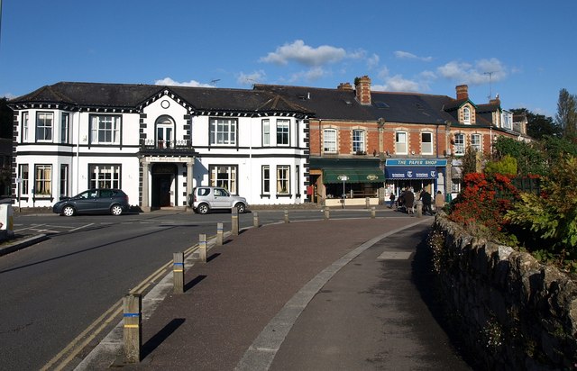
![]() The town of Bovey Tracey sits in a fine walking location on the edge of the Dartmoor National Park. There's some excellent local trails through the Bovey Valley, acres of local woodland and popular hill climbs to ancient forts. The town itself is also worth exploring with a Grade I listed 14th century church and the House of Marbles, a visitor attraction on the site of the historic pottery.
The town of Bovey Tracey sits in a fine walking location on the edge of the Dartmoor National Park. There's some excellent local trails through the Bovey Valley, acres of local woodland and popular hill climbs to ancient forts. The town itself is also worth exploring with a Grade I listed 14th century church and the House of Marbles, a visitor attraction on the site of the historic pottery.
This walk from the town visits some of the highlights of the area including Becky Falls, Houndtor Wood, Sharpitor and Lustleigh Cleave.
The walk starts in the town centre where you can pick up the Dartmoor Way and follow the waymarked footpath north west to Drakeford Bridge, passing through the pretty River Bovey Valley. You then turn west and follow woodland trails through Pullbrook Wood to Houndtor Wood, passing Trendlebere Down where there's the East Dartmoor Woods and Heath Nature Reserve. Continue west and you will soon come to the lovely Becky Falls, a popular local beauty spot.
The route continues north past Deal Cottage, Freeland, Manaton and Horsham before coming to Foxworthy Bridge. Here you turn south east to pass through Lustleigh Cleave. The Cleave (or 'cliff') is a great place for walkers with lots of footpaths and interesting flora and fauna. Look out for wildlife including deer, butterflies and the dipper bird by the river. In the spring you can also see lots of bluebells and foxgloves.
The route continues east past Sharpitor rocks to the village of Lustleigh where you could stop for refreshments. Near here you pick up the Dartmoor Way again retrace your steps back to Bovey Tracey.
Please scroll down for the full list of walks near and around Bovey Tracey. The detailed maps below also show a range of footpaths, bridleways and cycle paths in the area.
Postcode
TQ13 9AE - Please note: Postcode may be approximate for some rural locationsBovey Tracey Ordnance Survey Map  - view and print off detailed OS map
Bovey Tracey Open Street Map  - view and print off detailed map
*New* - Walks and Cycle Routes Near Me Map - Waymarked Routes and Mountain Bike Trails>>
Bovey Tracey OS Map  - Mobile GPS OS Map with Location tracking
Bovey Tracey Open Street Map  - Mobile GPS Map with Location tracking
Pubs/Cafes
Back in the town The Cromwell Arms is a good choice for some post walk refreshment. The historic 17th century inn serves good quality food and has a lovely large garden area to relax in. You can find them on Fore Street at postcode TQ13 9AE for your sat navs.
Dog Walking
The country, river and woodland on the route makes for a fine dog walk. The Cromwell Arms mentioned above is also dog friendly.
Further Information and Other Local Ideas
Just to the south east of the town there's the Little Bradley Ponds Nature Reserve where you look out for lots of birdlife on the water. The Chudleigh Knighton Heath Reserve and Clay Works are a little further on from there also.
The Wray Valley Trail starts in the village. The shared cycling and walking route runs along a disused railway line to Lustleigh and Moretonhampstead.
Near Manaton you can climb to the noteworthy Bowerman's Nose. The photogenic rock formation is located in a scenic spot on Hayne Down. The distinctive stack appears on many postcards and calendars of the area.
The National Trust's historic Parke Estate is located close to the town. You can find out more about the walks and the house on the Parke to Lustleigh Walk.
For more walking ideas in the area see the Devon Walks and the Dartmoor Walks pages.
Cycle Routes and Walking Routes Nearby
Photos
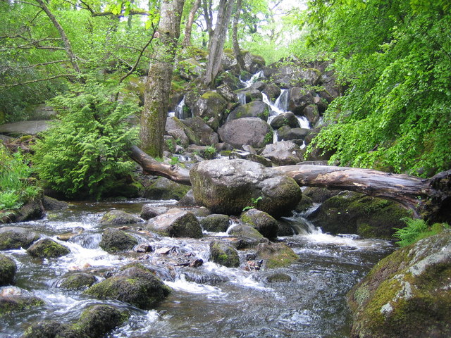
Dartmoor: Becky Falls. From a strictly physical geographical point of view this is the Becka Falls waterfall on the Becka Brook, which is a tributary of the River Bovey. The water cascades here over a boulder-strewn bed with a fall of about 70 feet or about 20 metres. However the land in which they occur is privately owned, and the owners have unsurprisingly turned the site into a tourist attraction in which the falls are the centrepiece of a woodland park containing a variety of different features such as a children's zoo, pony paddocks, and the inevitable gift shop. In the course of this commercialization the name of the falls has metamorphosed from Becka, as shown on the OS 1940s map, into Becky, as shown on the current OS map. The falls were first made accessible to the public in 1903.


