Werneth Low Country Park
![]()
![]() Enjoy fantastic views across Manchester and the Pennine Hills in this 200 acre country park. On a clear day the hills of North Wales are also visible beyond the Cheshire plain. In the park there are well surfaced footpaths and bridleways suitable for mountain biking.
Enjoy fantastic views across Manchester and the Pennine Hills in this 200 acre country park. On a clear day the hills of North Wales are also visible beyond the Cheshire plain. In the park there are well surfaced footpaths and bridleways suitable for mountain biking.
The Cown Edge Way and the Trans Pennine Trail both run through the park so there is scope for continuing your walk/cycle.
The park is located just 9 miles from Manchester city centre. The address is Higham Lane, SK14 5LR.
Postcode
SK14 5LR - Please note: Postcode may be approximate for some rural locationsPlease click here for more information
Werneth Low Country Park Ordnance Survey Map  - view and print off detailed OS map
Werneth Low Country Park Open Street Map  - view and print off detailed map
*New* - Walks and Cycle Routes Near Me Map - Waymarked Routes and Mountain Bike Trails>>
Werneth Low Country Park OS Map  - Mobile GPS OS Map with Location tracking
Werneth Low Country Park Open Street Map  - Mobile GPS Map with Location tracking
Pubs/Cafes
The conveniently located Hare & Hounds Inn is a popular choice for visitors to the park. The friendly pub has a good menu and decent selection of ales. There's also am excellent large garden area where you can enjoy fine views over Manchester with your meal. The pub is located very close to the Quarry Car Park on Werneth Low Rd with a postcode of SK14 3AA for your sat navs.
Dog Walking
The park is an excellent place for a bracing dog walk so you're likely to see other owners with their pets on a fine day. The Hare and Hounds mentioned above is also dog friendly.
Further Information and Other Local Ideas
From the park it's easy to follow the Cown Edge Way east to visit the Etherow Valley and the villages of Chisworth and Charlesworth.
If you head south you'll soon come to Etherow Country Park. There's woodland paths, riverside trails and a pretty lake to enjoy here. Near the park you could visit the historic Chadkirk Country Estate. There's a noteworthy 16th century chapel, a little cafe and a walled garden to enjoy here.
Just over a mile to the wst of the park you can pick up the Peak Forest Canal in Hyde. The canal forms part of the longer Cheshire Ring Canal Walk which explores the canals of the county. You could follow the towpath south into Bredbury or north towards Manchester.
The waymarked Tame Valley Way can also be picked up near the canal at Haughton Green. You can follow the trail along the River Tame to the nearby Reddish Vale Country Park. Near here there's also the bluebell woodland and wildlife in Haughton Dale Nature Reserve at Haughton Green.
The long distance Tameside Trail passes through the park. The 30 mile circular walk explores several of the highlights of the River Tame Valley. The route starts just to the east of the park at Broadbottom railway station.
For more walking ideas in the area see the Greater Manchester Walks page.
Cycle Routes and Walking Routes Nearby
Photos
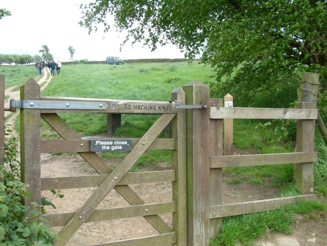
The eastern end near Windy Harbour, looking towards Hattersley and Mottram church
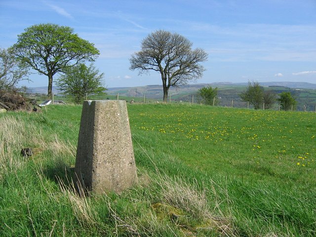
Trig pillar on the hill top, beside a field growing spring grass (and dandelions). Kinder Scout in the distance.
The small triangular area where Cowlishaw Road from Romiley meets Werneth Low Road is a popular viewpoint, affording views over Audenshaw and of planes approaching Manchester Airport.


