Allenheads Walks
![]()
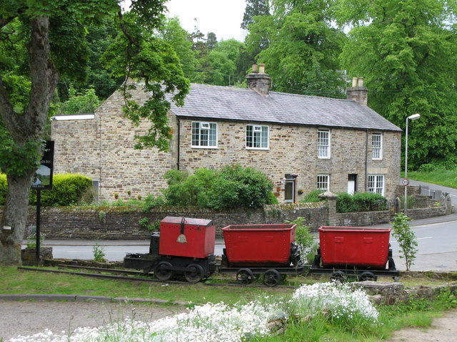
![]() This historic former mining village is located in the Pennines in the county of Northumberland. The village includes a heritage centre where you can learn all about the industrial history of the area. There's also a nature walk and a water-powered Armstrong engine which operated the machinery in the mineyard in the 19th century.
This historic former mining village is located in the Pennines in the county of Northumberland. The village includes a heritage centre where you can learn all about the industrial history of the area. There's also a nature walk and a water-powered Armstrong engine which operated the machinery in the mineyard in the 19th century.
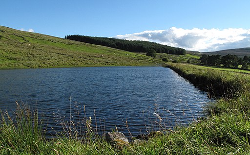
This circular walk starts from the heritage centre and follows public footpaths around the old mine buildings. You can then enjoy riverside footpaths along the River East Allen. There's some splendid views of the surrounding North Pennines hills and forestry to enjoy on the way. You'll also pass the pretty Springhouse Reservoir, a small lake lying to the south west of the settlement.
You can extend the walk by heading a short distance east to visit the picturesque Eastend Reservoir.
Postcode
NE47 9HN - Please note: Postcode may be approximate for some rural locationsAllenheads Ordnance Survey Map  - view and print off detailed OS map
Allenheads Open Street Map  - view and print off detailed map
Allenheads OS Map  - Mobile GPS OS Map with Location tracking
Allenheads Open Street Map  - Mobile GPS Map with Location tracking
Walks near Allenheads
- Nenthead - This circular walk explores the area around the Cumbrian village of Nenthead.
- Rookhope - This village in County Durham is an interesting place for a walk
- Ashgill Force - This circular walk visits the Ashgill Force waterfall in the North Pennines
- High Force Waterfall - Visit the spectacular Low Force and High Force waterfalls on this waterside walk in the North Pennines Area of Outstanding Natural Beauty
- Hardraw Force Walk - This walk takes you to the beautiful Hardraw Force waterfall in the Yorkshire Dales
- Cow Green Reservoir and Cauldron Snout - This walk takes you along the beautiful Cow Green Reservoir to the spectacular Cauldron Snout waterfall in the North Pennines AONB.
You start off at the car park at Cow Green Reservoir which is located on the eastern side of the water at a postcode of DL12 0HX - Burnhope Reservoir - Enjoy a peaceful circular walk around this reservoir in Weardale
- Bishop Auckland - This fine town in County Durham has some excellent walking opportunites with the River Wear and River Gaunless running through the town
- Stanhope - This small market town is located in County Durham on the River Wear
- Pow Hill Country Park and Derwent Reservoir - This walk explores Pow Hill Country Park and the expansive Derwent Reservoir in County Durham
- Slalely Forest - This large area of coniferous woodland is located a few miles south of Hexham
- Allendale - The village of Allendale is located in a lovely spot by the River East Allen in the North Pennines Area of Outstanding Natural Beauty
- Edmundbyers - This County Durham based village is located in a lovely spot close to Pow Hill Country Park and Derwent Reservoir.
- Allensford Country Park - Enjoy riverside woodland walks and magnificent views of the Derwent Valley in this country park near Consett
- Whitworth Hall Country Park - Explore 73 acres of parkland surrounding the Grade II listed stately mansion of Whitworth Hall in Spennymoor
- Alston - This Cumbrian market town is located in a lovely spot on the River South Tyne
Pubs/Cafes
The Allenheads Inn dates back to 1770 and serves good hearty food. There's a good sized car park and a bike lock up as well.
Further Information and Other Local Ideas
Just to the west is the Nenthead mining heritage centre. There's mine entrances, dumps, old buildings, reservoirs and some rare plants growing on the metal-rich mine dumps.
The epic Coast to Coast Whitehaven to Tynemouth Cycle Route also passes through the village.
Photos
Allenheads Mine photo (now disused). Located right in the centre of the village this mine was driven into the old lead workings. The right hand building contains the winding engine and the left hand one is where the Fluorspar was tipped out of the tubs. The entrance to the inclined drift can be seen on the left. This mine was formerly owned by British Steel as a source of Fluorspar - used as a flux in steelmaking.


