Nenthead Walks
![]()
![]() This circular walk explores the area around the Cumbrian village of Nenthead.
This circular walk explores the area around the Cumbrian village of Nenthead.
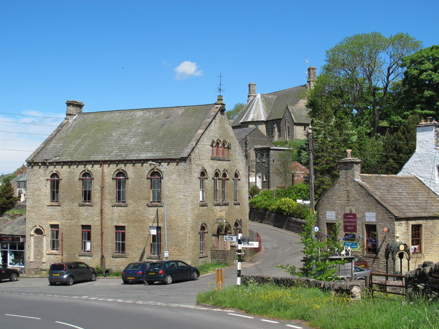
It's a significant location as one of England's highest villages and the home of the historic Nenthead Mines. The settlement is located close to Alston and Garrigill in the North Pennines.
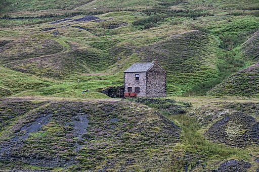
The walk starts from the Nenthead Mines Heritage Centre where car parking is available. At the centre you can learn all about the lead and zinc mining history of the North Pennines. There's also mine entrances, dumps, old buildings and some rare plants growing on the metal-rich mine dumps.
The route then heads south past the old mines to the picturesque Perry's Dam. From here you turn west to follow footpaths past Flinty Fell to visit another local highlight at Ashgill Force Waterfall.
At the falls you pick up the South Tyne Trail and follow it north along the River South Tyne to the village of Garrigil.
The final section follows a country lane east past Nunnery Hill to return to Nenthead.
Postcode
CA9 3NR - Please note: Postcode may be approximate for some rural locationsNenthead Ordnance Survey Map  - view and print off detailed OS map
Nenthead Open Street Map  - view and print off detailed map
Nenthead OS Map  - Mobile GPS OS Map with Location tracking
Nenthead Open Street Map  - Mobile GPS Map with Location tracking
Walks near Nenthead
- Alston - This Cumbrian market town is located in a lovely spot on the River South Tyne
- Ashgill Force - This circular walk visits the Ashgill Force waterfall in the North Pennines
- South Tyne Trail - Travel through the fabulous North Pennines and enjoy some spectaular scenery on this shared walking and cycle path.
The trail starts off at Tyne Head - the source of the River South Tyne - High Force Waterfall - Visit the spectacular Low Force and High Force waterfalls on this waterside walk in the North Pennines Area of Outstanding Natural Beauty
- Hardraw Force Walk - This walk takes you to the beautiful Hardraw Force waterfall in the Yorkshire Dales
- Cow Green Reservoir and Cauldron Snout - This walk takes you along the beautiful Cow Green Reservoir to the spectacular Cauldron Snout waterfall in the North Pennines AONB.
You start off at the car park at Cow Green Reservoir which is located on the eastern side of the water at a postcode of DL12 0HX - Isaac's Tea Trail - Follow in the footsteps of the legendary tea seller Isaac Holden on this challenging circular walk through the North Pennines.
The walk starts at the pretty village of Allendale Town, and heads south along the River East Allen and through West Allen Dale to Nenthead, where you will find the interesting Nenthead Mining Centre - Burnhope Reservoir - Enjoy a peaceful circular walk around this reservoir in Weardale
- Allenheads - This historic former mining village is located in the Pennines in the county of Northumberland
- Garrigill - This Cumbrian village is located in a remote and scenic spot in the North Pennine AONB.
Pubs/Cafes
The Hive at Nenthead is a nice place for some post walk refreshment. The cafe has been converted from an ancient Wesleyan Chapel with a magnificent organ and period features. There's also a fine art gallery, musical performances and a gift shop. The food is varied and of a good quality with mostly locally source ingredients. Hearty scones and cake are available as fuel for walkers and cyclists.
Dog Walking
The area makes for a fine dog walk and the Hive mentioned above is also dog friendly with biscuits available.
Further Information and Other Local Ideas
The village is on the Coast to Coast Whitehaven to Tynemouth (C2C) Cycle route. As such the heritage centre is a popular place for a pit stop on the long distance cycle route.
Photos
Nenthead Lead Mines. The area was a significant centre for lead and silver mining. George Liddle constructed the first smelt mill at Nenthead in 1737, and the London Lead Company later added to it. The smelt mill could smelt 8,000 bings, or 64,000 long hundredweight (3,300 t), of ore annually by 1882.


