Arkengarthdale Walks
![]()
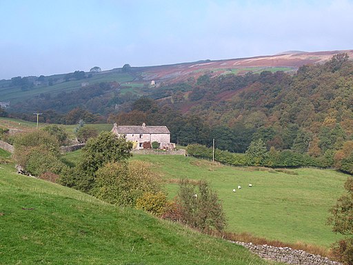
![]() This walk explores lovely Arkengarthdale, the northernmost of the Yorkshire Dales.
This walk explores lovely Arkengarthdale, the northernmost of the Yorkshire Dales.
The route through the dale takes you along the Arkle Beck from Langthwaite to Whaw Bridge.
The walk starts from the car park at Langthwaite and then picks up footpaths heading north west along the pretty beck towards Whaw and Seahouses. Along the way there's picturesque old bridges, evidence of the area's mining history and fine views of the surrounding dales countryside.
To continue your walking in the area head south to Reeth where you can enjoy more waterside walking along the River Swale.
If you continue north west through the dale you will eventually come to the splendid Tan Hill Inn. The Inn is world famous as Britain’s highest public house at 1,732 feet (528m) above sea level. It dates back to the 17th century and has a wonderful interior with exposed beams, stone-flagged floor and welcoming fire. There's also a nice outdoor seating area with some of the best views in the country. You can find the inn on the Long Causeway at a postcode of DL11 6ED.
Postcode
DL11 6EJ - Please note: Postcode may be approximate for some rural locationsArkengarthdale Ordnance Survey Map  - view and print off detailed OS map
Arkengarthdale Open Street Map  - view and print off detailed map
Arkengarthdale OS Map  - Mobile GPS OS Map with Location tracking
Arkengarthdale Open Street Map  - Mobile GPS Map with Location tracking
Pubs/Cafes
Back in Langthwaite there's the Red Lion for some post walk refreshment. They serve a good selection of ales and sell some tasty pasties as well.
Further Information and Other Local Ideas
The Barningham Trail can be picked up just to the east of Langthwaite. The circular trail explores the moorland and hills to the north east. You could also visit Gunnerside Gill in the adjacent Swaledale. In this area there's also the popular Keld Circular Waterfall Walk which visits a series of pretty falls including Kisdon Force.
The circular Fremington Edge Walk starts from nearby Reeth and passes through the southern part of Arkengarthdale. The elevated ridge walk provides some wonderful views over the area and can be found less than a mile east of the village.
To the south of Reeth you can pick up the circular Grinton Walk. The route visits the historic Marrick Priory, the elevated Cogden Moor and the pretty Cogden Gill.
For more walking ideas in the area see the Yorkshire Dales Walks page.
Cycle Routes and Walking Routes Nearby
Photos
Rainbow over Wood House, Arkengarthdale. As the heavy shower passed, there were still rainbows to be had, and a bit of manoeuvring got the pot of gold for this one to land on Wood House, one of a cluster of farms connected with Whaw in Arkengarthdale. Behind it, a patchwork of improved pasture and bracken-infested fields rises to Kitley Hill.


