Hallaton Walks
![]()
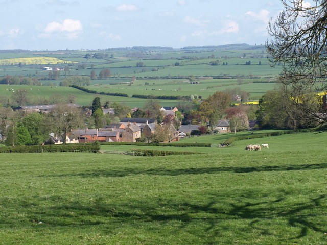
![]() This pretty Leicestershire village is well worth a visit with its picturesque village pond, 13th century church and thatched cottages. There's also a lovely pub with a garden and farm animals to visit.
This pretty Leicestershire village is well worth a visit with its picturesque village pond, 13th century church and thatched cottages. There's also a lovely pub with a garden and farm animals to visit.
Hallaton is the location for the annual bottle kicking contest which takes place on Easter Monday. See below for details and a video.
This route uses sections of the Leicestershire Round, the Midshires Way and the Macmillan Way to create a circular walk through the surrounding countryside. On the way you'll pass a series of neighbouring villages and enjoy some fine scenic views.
The walk starts in the village where you can pick up the Leicestershire Round and follow the waymarked footpath south west to Cranoe, passing the site of the medieval village of Othorpe on the way. At Cranoe you can pick up the Midshires Way and follow it south to Welham where there are views of the River Welland.
The route continues by looping around Sutton Bassett where you can pick up the Macmillan Way nearby. This will take you north past Weston by Welland where you cross the river and continue past Medbourne to Slawston Hill. The final section runs past Hallaton House Farm before returning you to the village.
Postcode
LE16 8UJ - Please note: Postcode may be approximate for some rural locationsHallaton Ordnance Survey Map  - view and print off detailed OS map
Hallaton Open Street Map  - view and print off detailed map
Hallaton OS Map  - Mobile GPS OS Map with Location tracking
Hallaton Open Street Map  - Mobile GPS Map with Location tracking
Walks near Hallaton
- Saddington Reservoir - Enjoy a circular walk to this pretty reservoir from the Leicestershire village of Saddington
- Grand Union Canal Walk - Follow the towpath of Britain's longest canal from London to Birmingham on this fabulous waterside walk
- Foxton Locks - This impressive staircase of locks in Foxton are a popular tourist attraction
- Uppingham - The town of Uppingham is located in a pleasant position in Rutland
- Market Harborough Canal - Follow the Market Harborough Arm of the Grand Union Canal from Market Harborough to Foxton Locks on this waterside walk in Leicestershire
- Eyebrook Reservoir - Enjoy a stroll alongside this lovely reservoir near Corby
- Brocks Hill Country Park - Enjoy woodland, meadows, ponds and a community orchard in this 67 acre country park in Leicester
- River Soar - This lovely circular waterside walk takes you along both sides of the River Soar in the city centre of Leicester
- Leicestershire Round - Explore the countryside, villages, canals, rivers and reservoirs of Leicestershire on this interesting and varied circular walk
- Midshires Way - This route follows public bridleways and quiet country lanes through Middle England, from Bledlow, near Aylesbury in Buckinghamshire, to Stockport in Greater Manchester
- Macmillan Way - This epic long distance path links Boston in Lincolnshire to Abbotsbury in Dorset
- Wistow - This Leicestershire based hamlet is a fine place to visit with a variety of attractions and an interesting history.
- Eyebrook Reservoir - Enjoy a stroll alongside this lovely reservoir near Corby
- Rockingham Castle - The grounds and pretty gardens surrounding this castle near Corby are ideal for an easy afternoon stroll
- Around Corby - This is a delightful 31 mile circular walk which visits a number of pretty villages and parks around the town of Corby in Northamptonshire
- East Carlton Park - This popular country park near Corby has a number of nature trails taking you through the mature woodland and grasslands surrounding the 19th century East Carlton Hall
- Kibworth - This Leicestershire village is nicely positioned for some fine canal and country walking
Pubs/Cafes
Back in the village you can enjoy some well earned refreshment at The Fox Inn. They serve a fine Sunday roast and have a lovely large garden area to relax in on warmer days. Out here you can see animals such as ponies, goats and ducks. You can find them at postcode LE16 8UJ.
Dog Walking
The country trails make for a fine dog walk and the Fox mentioned above is also dog friendly.
Further Information and Other Local Ideas
Head west to nearby Kibworth and you could enjoy some waterside walking at the Grand Union Canal and Saddington Reservoir.
To the east there's waterside paths around the expansive Eyebrook Reservoir and interesting history at Rockingham Castle near Corby.
For more walking ideas in the area see the Leicestershire Walks page.
Photos
Village pond at Hallaton. The village is known for its bottle kicking ritual and "Hare Pie Scramble", which take place usually on Easter Monday. The tradition dates back to the 18th century and involves three teams trying to move a bottle using any means possible. It is generally a rough affair with injuries common. See the video below for more details.
Othorpe House. All that remains at the site of the deserted village of Othorpe. The building dates from mid 19th century.


