Aviemore Walks
![]()
![]() The town of Aviemore is a great place for exploring a beautiful region of the Cairngorms National Park. In the area you will find numerous lochs, forests, mountains and rivers.
The town of Aviemore is a great place for exploring a beautiful region of the Cairngorms National Park. In the area you will find numerous lochs, forests, mountains and rivers.
This walk from the town, follows a section of the Speyside Way to take you to Kincraig. On the way you'll visit Loch Alvie and Loch Insh with views of the River Spey to enjoy. There's also some attractive woodland sections through the Kinrara estate.
The Craigellachie Nature Reserve is very close to the town and a great option for walkers. Just head west from the town and you will soon come to the reserve which includes waymarked paths, several small lochs, woodland trails and stunning views of the Cairngorms.
Loch an Eilein can be found just to the south of the town. There's a nice footpath around the loch which is in a beautiful and tranquil location with the still waters surrounded by stunning hills and mountains.
The Speyside Way long distance trail is another great option. You can follow the trail north to Boat of Garten and visit the Osprey Centre Nature Reserve next to Loch Garten in the Abernethy Forest. This includes the Osprey Centre where you can observe the birds nesting in the Caledonian pineforest and view the birds on the live CCTV camera. Near here there's also the smaller Loch Vaa which has particularly beautiful clear waters.
A few miles to the east is the expansive Glenmore Forest Park. Here you can visit Loch Morlich and look out for wildlife including Scottish Crossbill, Crested Tit, Capercaillie and Red Deer. There's also the hike to the unusually coloured Green Loch to try here.
Please scroll down for the full list of walks near and around Aviemore. The detailed maps below also show a range of footpaths, bridleways and cycle paths in the area.
Aviemore Ordnance Survey Map  - view and print off detailed OS map
Aviemore Open Street Map  - view and print off detailed map
Aviemore OS Map  - Mobile GPS OS Map with Location tracking
Aviemore Open Street Map  - Mobile GPS Map with Location tracking
Pubs/Cafes
The Old Bridge Inn is a fine choice for some post walk refreshments. It's in an ideal location right next to the banks of the famous River Spey. They have a good menu and a nice garden area to sit out in if the weather is fine. You can find the pub at 23 Dalfaber Rd with a postcode of PH22 1PU for your sat navs.
Dog Walking
It's a lovely area for a dog walk and the Old Bridge Inn mentioned above is also dog friendly.
Further Information and Other Local Ideas
Just a mile to the east of the town, on the opposite side of the River Spey, you'll find Loch Pityoulish. This picturesque loch is a very peaceful place with fewer visitors than the more popular Loch Morlich. You can follow a little track along the shoreline with fine views to the surrounding mountains.
Near Loch Insh there's also the Glen Feshie Waterfall Walk. There's a lovely trail along the River Feshie with waterfalls and wonderful views of the surrounding mountains here.
For more walking ideas in the area see the Cairngorms Walks page.
Cycle Routes and Walking Routes Nearby
Photos
Bogach, Lynwilg. A wetland which takes the outflow from Loch Alvie, before it enters the Spey. Craigellachie NNR in the distance.
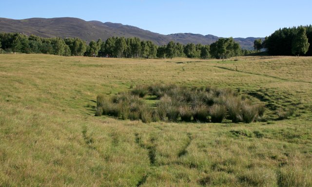
Luachair Bhog Fhlurach, Dalraddy Moor. The Gaelic name for the rush which has colonised this depression on Dalraddy Moor. It is common throughout Scotland at lower levels and is unpalatable to sheep and cattle.
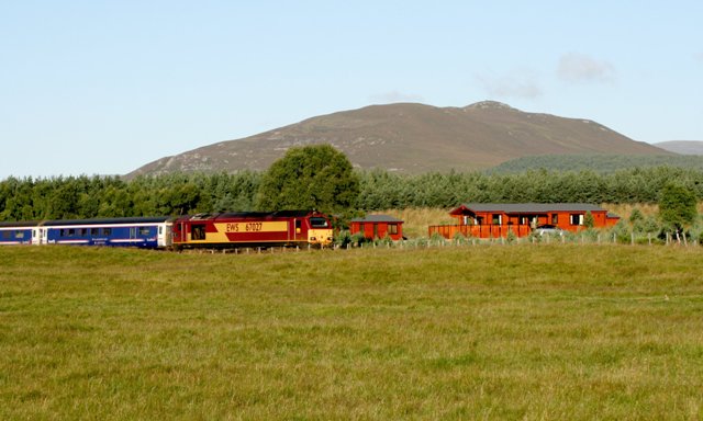
Bridge over railway at Speybank. Taking the road to the houses at Speybank over the Inverness to perth railway line.
Alvie Church. An aerial view of this 12th century church on the shores of Loch Alvie taken from the Duke of Gordon's Monument on Torr Alvie. During renovations in the late 19th century 150 bodies were discovered lying head to head beneath the floor. They are believed to have been the victims of a battle although no weapons were found (it was usual to bury them with the fallen) and there is no written record of any battle nearby.


