Barnoldswick Canal Walk
![]()
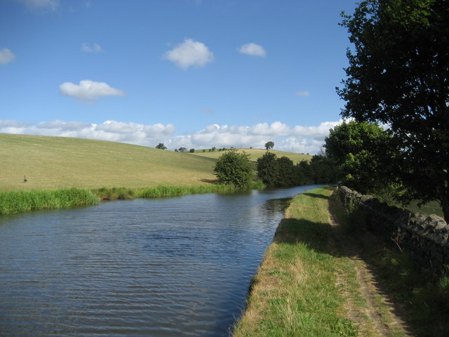
![]() Enjoy an easy waterside walk along the towpath of the Leeds and Liverpool Canal on this route in Lancashire and Yorkshire. The route runs from the village of Barnoldswick to Gargrave along a pretty section of the canal, with nice open views of the surrounding countryside most of the way. It's just over 7 miles so will probably take around 2-3 hours.
Enjoy an easy waterside walk along the towpath of the Leeds and Liverpool Canal on this route in Lancashire and Yorkshire. The route runs from the village of Barnoldswick to Gargrave along a pretty section of the canal, with nice open views of the surrounding countryside most of the way. It's just over 7 miles so will probably take around 2-3 hours.
The walk starts on Skipton Road which crosses the canal, just to the east of the town centre. From here you can access the canal towpath on some steps. Follow it north towards the pretty Greenber Field Locks and Greenber Field Bridge.
You continue towards East Marton, crossing the Lancashire/Yorkshire border as you go. The final section takes you through Bank Newton, before finishing in Gargrave.
The walk can be extended on the Skipton Canal Walk which will take you to the popular town of Skipton from Gargrave. Here you can try our Gargrave Circular Walk and explore the area around the village.
If you head south along the canal you can visit Foulridge Reservoir where there's a nice trail running around the perimeter of the water.
The reservoir is located just a few miles to the south near Colne.
Barnoldswick Canal Walk Ordnance Survey Map  - view and print off detailed OS map
Barnoldswick Canal Walk Open Street Map  - view and print off detailed map
Barnoldswick Canal Walk OS Map  - Mobile GPS OS Map with Location tracking
Barnoldswick Canal Walk Open Street Map  - Mobile GPS Map with Location tracking
Pubs/Cafes
This old mill town has some classic pubs for refreshments after your walk. The Barlick Tap is a fine micro pub serving an excellent range of Belgian beers and real ales. You can find the pub at 6 Newtown with a postcode of BB18 5UQ for your sat navs. The pub is also dog friendly if you have your canine friend with you.
Further Information and Other Local Ideas
If you fancy a climb from the town then Weets Hill is located just a couple of miles to the south west. From the summit there are fine views fine views over the town, east Lancashire, the north Ribble Valley, north Aire Valley and the Yorkshire Dales.
Just to the east are the villages of Thornton-in-Craven and Elslack where you can enjoy a peaceful walk around Elslack Reservoir. There's also a fine 17th century pub in Elslack village which is well worth a visit.
Just to the east is neighbouring Earby where you can visit the delightful Earby Waterfalls on the Wencliffe Brook.
For more walking ideas in the area see the Forest of Bowland Walks page.


