Bracknell Forest Ramblers Walk with OS Map
![]()
![]() This circular walk takes you on a tour of the woodland and countryside of Bracknell Forest in Berkshire.
This circular walk takes you on a tour of the woodland and countryside of Bracknell Forest in Berkshire.
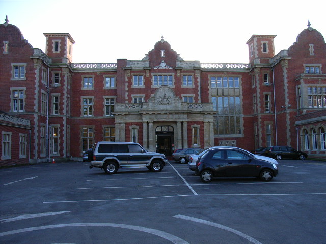
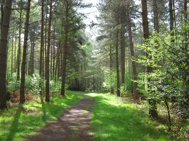
The walk passes through varied scenery including coniferous forest, heathland and unspoilt open farmland. Walk highlights include Easthampstead Park with its Victorian Country Mansion surrounded by 60 acres of parkland and Pope’s Meadow where 18th century poet Alexander Pope lived.
You will also pass a Site of Special Scientific Interest at Englemere Pond where the pond and surrounding land is full of wildlife.
The walk starts and finishes at The Look Out Discovery Centre, Nine Mile Ride, 2 miles south of Bracknell town centre where there is ample free parking. The centre has some interesting nature exhibits, lots of information about the area and cycle hire. From here you head south to Gravel Hill, Pudding Hill and Butter Hill before picking up the waymarked Three Castles Path and following it past Crowthorne and Sandhurst. Around here you could take a detour from the route to visit the lovely Tri Lakes Country Park and Horseshoe Lake where there are some nice waterside trails.
The route turns north at Sandhurst heading to Gardener's Green, passing the Heath Lake Nature Reserve where you can look out for herons and other birds. The route then heads past the Victorian mansion at Easthampstead Park before continuing north through Popeswood and Binfield. Near here you turn east to Tickleback Row, Moss End, Warfieldand Winkfield Row.
The final section takes you south through Burleigh and back into the woodland around the pretty Englemere Pond. The route then heads through Swinley Park before returning to the heritage centre.
Postcode
RG12 7QW - Please note: Postcode may be approximate for some rural locationsPlease click here for more information
Bracknell Forest Ramblers Route Ordnance Survey Map  - view and print off detailed OS map
Bracknell Forest Ramblers Route Open Street Map  - view and print off detailed map
*New* - Walks and Cycle Routes Near Me Map - Waymarked Routes and Mountain Bike Trails>>
Bracknell Forest Ramblers Route OS Map  - Mobile GPS OS Map with Location tracking
Bracknell Forest Ramblers Route Open Street Map  - Mobile GPS Map with Location tracking
Pubs/Cafes
At the start/end of the route you can enjoy refreshments at the cafe in The Look Out centre. There's also picnic tables outside if the weather is good.
Dog Walking
The woodland trails in the forest are ideal for dog walkers so you're bound to see other owners on your visit.
Further Information and Other Local Ideas
A few miles to the south east you'll find the popular Chobham Common. The expansive common has miles of good cycling and walking trails taking you to grassland, lowland heath and woodland. It's also notable as the largest National Nature Reserve in the south east of England. As such there is a diverse range of flora and fauna to see here.
The route passes close to the town of Ascot where you can visit the famous racecourse, home to Royal Ascot.
For more walking ideas in the area see the Berkshire Walks page.
Cycle Routes and Walking Routes Nearby
Photos
Bank and ditch of Caesar's Camp, Bracknell Caesar's Camp in Swinley Forest by Bracknell is an iron age hillfort about 2500 years old. The bank and ditch are a mile long and enclose seven hectares. It has not been excavated so the arrangement of buildings is not known. It was covered by conifer forest until recently, the Crown estate and Bracknell Forest Borough Council are reintroducing heathland plants.
Clock Fountain, Charles Square, Bracknell. The fountain, in Charles Square, is also a clock and tells the time, with the middle ring of jets representing the hours and the outer ring the minutes. It tells the time every five minutes, reverting to a random display of water jets in between.
Easthampstead Park. This Victorian Mansion now serves as a conference centre. It dates from 1864 and has been described as "a building of historic and architectural interest, in Jacobean style with curved gables, pierced stone parapet and stone frontispiece of naive classicism".
Elevation Profile


