Burton Upon Trent Walks - Around and Near
![]()
![]() This Staffordshire based market town has some fine riverside and canalside walks to try. The historic brewing settlement is dotted with pleasant local parks and pockets of woodland right in the centre of town.
This Staffordshire based market town has some fine riverside and canalside walks to try. The historic brewing settlement is dotted with pleasant local parks and pockets of woodland right in the centre of town.
This circular walk explores Stapenhill Gardens, the Stapenhill Viaduct, the River Trent and the Trent Washlands area in the town.
The walk starts in the pretty Stapenhill Gardens where there are some nice trails around the gorgeous flower beds. The park also includes wild flower meadows and a large cement-rendered sculpture of a swan that has been described as a "Burton landmark". There is a nice video below which showcases the gardens.
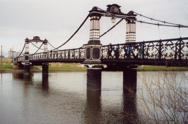
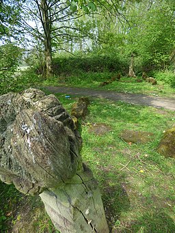
After exploring the gardens you can then cross the river on the 19th century Ferry Bridge and explore the riverside gardens and woodland on the opposite side. This area is known as the Washlands and includes a sculpture trail with some impressive pieces. You can continue along the Stapenhill Viaduct and then visit The Abbey Trail by Peel's Cut. Around here you will pass Burton's busy market and the Church of St Modwen. You then return on more riverside paths to Stapenhill where the walk finishes. Much of this route takes place on a designated cycle path so also makes for a nice easy cycle in the town centre.
Postcode
DE15 9AP - Please note: Postcode may be approximate for some rural locationsBurton Upon Trent Ordnance Survey Map  - view and print off detailed OS map
Burton Upon Trent Open Street Map  - view and print off detailed map
*New* - Walks and Cycle Routes Near Me Map - Waymarked Routes and Mountain Bike Trails>>
Burton Upon Trent OS Map  - Mobile GPS OS Map with Location tracking
Burton Upon Trent Open Street Map  - Mobile GPS Map with Location tracking
Walks near Burton Upon Trent
- Burton on Trent to Barton under Needwood Canal Walk - This walk follows a lovely section of the Trent and Mersey Canal from Burton Upon Trent to Barton Marina in the the nearby village of Barton under Needwood
- Trent and Mersey Canal - Follow the Trent and Mersey Canal through Derbyshire, Staffordshire and Cheshire on this long distance waterside walk
- Branston Water Park - Enjoy woodland, wetland and meadow in this lovely park in Burton Upon Trent
- Willington - This south Derbyshire based village has some pleasant waterside walks along the local canal and river
- Mercia Marina - This walk visits the lovely Mercia Marina in Willington, Derbyshire
- National Forest Trail - Explore the National Forest in Leicestershire and Derbyshire on this super figure-of-eight cycle ride
- Foremark Reservoir - This walk visits the pretty Foremark Reservoir near Burton Upon Trent in Derbyshire
- National Memorial Arboretum - This peaceful circular walk takes you through the National Memorial Arboretum and its surrounding countryside in Alrewas, near Lichfield in Staffordshire
- Horseshoe Trail - This cycling and walking trail in Derbyshire takes you on a tour of the countryside, villages and reservoirs near Burton-Upon-Trent and Swadlincote
- Alrewas and Fradley Junction - Enjoy a nice easy canal walk from Alrewas to Fradley Junction and then onto the village of Fradley
- Tutbury - This pretty Staffordshire village sits in a lovely position next to the River Dove and the border with Derbyshire.
- Rolleston on Dove - This Staffordshire village is a pleasant place to start a walk with some lovely country trails through the River Dove valley and the surrounding National Forest
- Yoxall - This Staffordshire bases village sits close to the town of Burton Upon Trent and the Rivers Trent and Swarbourn.
- Badger Wood - This walk explores Badger Wood, on the edge of Coton Park in the National Forest, South Derbyshire.
Pubs/Cafes
The Elms is located just north of Stapenhill park. It sits in a fine location overlooking the river. It's an attractive looking place with an open fire, conservatory and some outdoor seating if the sun is shining. You can find the pub at 36 Stapenhill Road with a postcode of DE15 9AE for your sat navs.
Dog Walking
The parks and woods on the route are ideal for dog walking with many people choosing to exercise their pets in this area. The Elms pub mentioned above is also dog friendly.
Further Information and Other Local Ideas
A must visit in the town is the National Brewery Centre. Here you can learn about the town's long an interesting associations with the brewing industry. The museum celebrates the brewing heritage of Burton and features exhibits showcasing the history of brewing techniques. You can find them on Horninglow Street with a postcode of DE14 1NG for your sat navs.
Head north east along the canal and you could pay a visit to the neighbouring village of Willington. Here you could try the Willington Walk and visit the nearby Gravel Pits Nature Reserve. The Mercia Marina is also located in this area. It is notable as the largest marina in the UK.
To the south there's the National Memorial Arboretum and the Alrewas and Fradley Junction Walk to try.
Head a few miles north of the town and you could visit the delightful village of Tutbury. There's nice trails here along the River Dove to the ruins of the photogenic medieval ruined castle. Rolleston on Dove with its 12th century church and 16th century pub is also located in this area.
Just to the south there's the Rosliston Forestry Centre. The centre provides a wealth of information on the area and also has on site bike hire. The surrounding parkland is well worth exploring too with woodland trails, meadows, ponds, lots of butterflies and some interesting sculptures to see. The Woodland Trust's Badger Wood can also be accessed in this area.
For more walking ideas in the area see the Staffordshire Walks and the National Forest Walks pages.
Photos
A walk around The Washlands in Burton upon Trent. Around Andressey Island. The River Trent flows past here. Washlands Sculpture Trail. Land and Water - Viking boat sculpture, hidden amongst the trees, 1994 by Rosemary Terry.
Water Tower. The water tower, dated 1866, was once part of one of the many breweries. It is now part of a leisure area near the River Trent.


