Cholmondeley Walks
![]()
![]() This walk visits the Cholmondeley Castle estate, located in the village of Cholmondeley near Malpas in Cheshire.
This walk visits the Cholmondeley Castle estate, located in the village of Cholmondeley near Malpas in Cheshire.
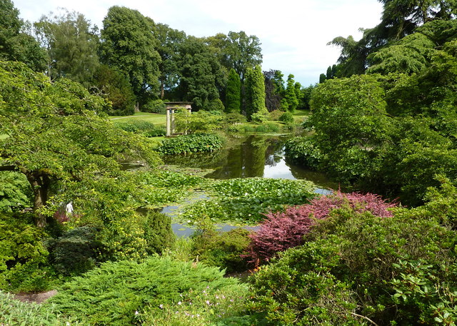
The 19th century castle is surrounded by 70 acres of beautiful parkland and gardens with a series of well laid footpaths to try. Features in the park include a herbaceous border, Folly Water Gardens, Rose Garden, Glade, Arboretum, a lakeside trail and the ornamental woodland upon Tower Hill.
You can extend the walk by heading north through the old castle estate on public footpaths towards Bulkeley Hill.
To the north west there's the climb to Bickerton Hill and Maiden Castle where you can enjoy wonderful views over the area from the ancient hill fort.
Postcode
SY14 8AH - Please note: Postcode may be approximate for some rural locationsCholmondeley Ordnance Survey Map  - view and print off detailed OS map
Cholmondeley Open Street Map  - view and print off detailed map
Cholmondeley OS Map  - Mobile GPS OS Map with Location tracking
Cholmondeley Open Street Map  - Mobile GPS Map with Location tracking
Further Information and Other Local Ideas
The popular Sandstone Trail runs just to the east of the castle. You could follow this south to Whitchurch and enjoy a stroll along the Shropshire Union Canal.
Bunbury locks and the associated village of Bunbury are located just to the north. The impressive staircase locks on the Shropshire Union Canal and the delightful historic settlement are well worth a visit.
Cycle Routes and Walking Routes Nearby
Photos
Cholmondeley Estate track south of Bulkelehay. The private road in the Cholmondeley Estate is a public right of way. The farmhouse in the distance is in the centre of the hamlet of Bulkelehay. The brook which is one of the source streams of the Weaver runs along the low point of the shallow valley, at the line of trees (centre)


