Cranleigh Walks
![]()
![]() This Surrey based village is located near Guildford in the north-west corner of the Weald.
This Surrey based village is located near Guildford in the north-west corner of the Weald.
The village is well served by a number of public footpaths heading into the surrounding countryside and expansive forest areas.
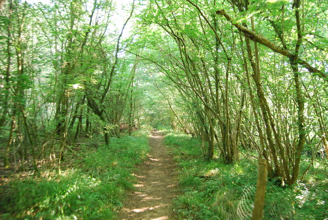
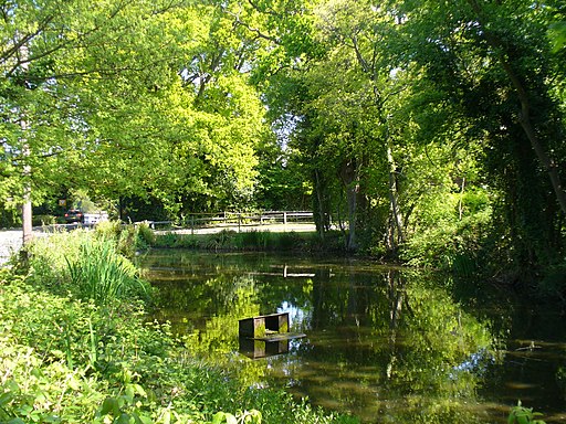
This circular walk from the village takes you east to visit neighbouring Ewhurst Green. On the way you will pass through Book Hurst Wood and Canfold Wood where you can see pretty bluebells in the springtime. Ewhurst Green is a nice place for a stroll too with oasthouses, a village pond and an interesting old church to see.
To continue your walking in the area head north to Winterfold Forest where you will find miles of walking and cycling trails including the epic Greensand Way.
On the western side of the village you can pick up the Downs Link which links the North and South Downs National Trails.
Cranleigh Ordnance Survey Map  - view and print off detailed OS map
Cranleigh Open Street Map  - view and print off detailed map
Cranleigh OS Map  - Mobile GPS OS Map with Location tracking
Cranleigh Open Street Map  - Mobile GPS Map with Location tracking
Walks near Cranleigh
- Guildford - The town of Guildford has a huge selection of walks to choose from with several long distance trails, hill climbs, parks, rivers and canals to explore.
This long circular walk makes use of some of the waymarked footpaths running through the area, showcasing the best of the surrounding North Downs countryside - Winterfold Forest - This lovely area of the Surrey Hills is a popular place for walkers and cyclists
- Greensand Way - The Greensand Way runs from Haslemere in Surrey to Hamstreet in Kent following the ridge of greensand rock that crosses the two counties
- Downs Link - This is a terrific walking or cycling path running from St Martha's Hill in Guildford to Shoreham by Sea
- Holmbury Hill - Climb to the 856 feet (261 m) summit of Holmbury Hill on this circular walk in the Surrey Hills
- Abinger Common - Enjoy a walk across Abinger and Wotton Commons before a climb to Leith Hill on this circular walk in the Mole Valley
- Friday Street - This pretty little hamlet sits in a pleasant location on the slopes of Leith Hill in Surrey.
- Guildford Canal Walk - A nice waterside walk from Guildford to Godalming along the River Wey Navigation Canal
- Wey South Path - Follow the Wey River and the Wey and Arun Canal on this wonderful waterside walk through Surrey and Sussex
- Chiddingfold - This pretty Surrey based village is located in the Waverley area of the county
- Hydon's Ball and Hydon Heath - This National Trust owned hill is one of the high points of Surrey and a great place to stretch your legs
- Witley Common - This large area of common land in Surrey consists of heathland, ponds and birch, oak and pine woodland
- River Wey Navigation - Follow the River Wey Navigation towpath from Godalming to the River Thames at Weybridge on this super waterside walk
- Fox Way - This circular walk takes you on a tour of the countryside, woodland and canals surrounding Guildford in Surrey
- Puttenham Common - Enjoy a peaceful walk through the woodland and heathland of Puttenham Common in the North Downs, near Guildford
- Chinthurst Hill - This walk visits a lovely nature reserve and viewpoint in the Surrey Hills AONB
Pubs/Cafes
For some rest and refreshment after your exercise head to the 17th century Three Horseshoes. The old fashioned village inn has a delightful interior with wooden floors, nooks, crannies and beams and even an inglenook fireplace with a roaring fire in winter. Outside there's a lovely garden area with lots of plants and herbs and private "wine huts" available for booking.
They serve good quality food and have a fine selection of real ales too.
You can find them on the High Street with postcode GU6 8AE for your sat navs.
Dog Walking
The woodland trails surrounding the village are ideal for a dog walk. The Three Horseshoes mentioned above is also dog friendly.
Further Information and Other Local Ideas
For an easy waterside walk head west to pick up the Wey South Path. The long distance route takes you along the Wey River and the Wey and Arun Canal towards Amberley in Sussex.


