Didcot Walks
![]()
![]() The Oxfordshire town of Didcot has some nice trails to follow into the surrounding Chilterns countryside.
The Oxfordshire town of Didcot has some nice trails to follow into the surrounding Chilterns countryside.
This walk visits some of the highlights of the area using a mixture of country lanes, public footpaths and waymarked long distance trails. You'll visit the famous Didcot Railway Centre, the scenic hills of Wittenham Clumps, the River Thames and the interesting Roman town of Dorchester.
The walk starts at Didcot Junction in the town centre and follows a path around the railway centre. A shared cycling and walking trail then takes you through the countryside to the village of Long Wittenham. Here you can take a small detour to visit the River Thames around Clifton Cut.
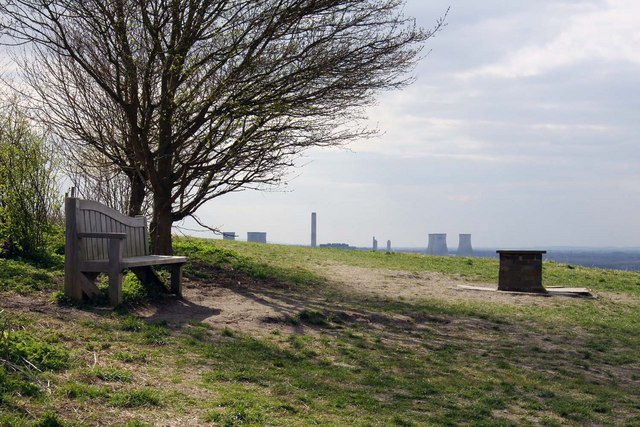
The route heads through the village and then follows a country lane to Little Wittenham and the Wittenham Clumps. The 'clumps' include Round Hill at 390 feet (120 m) and the 350 feet (110 m) Castle Hill which is about 380 yards (350 m) to the south-east. The Clumps are one of the most visited outdoor sites in Oxfordshire, attracting over 200,000 visitors a year. From the hill summits there are fine views over the surrounding countryside.
After exploring the hills the route then heads through Little Wittenham Wood to the River Thames. You cross the river close to the pretty Day's Lock before following a country path to Dorchester. A must see in the town is the magnificent Dorchester Abbey. The abbey dates from 1140 and contains a fascinating museum detailing the history of the area.
To extend your walking around Didcot you can continue along the Thames Path towards Wallingford or Abingdon. You could also try our Dorchester Circular Walk which explores the area around the town. To the south of the town you can try our Blewbury and Blewburton Hill Walk which visits an interesting Iron Age Hillfort.
Didcot Ordnance Survey Map  - view and print off detailed OS map
Didcot Open Street Map  - view and print off detailed map
Didcot OS Map  - Mobile GPS OS Map with Location tracking
Didcot Open Street Map  - Mobile GPS Map with Location tracking
Walks near Didcot
- Wittenham Clumps - Climb to these two hills near Dorchester for wonderful views over the Oxfordshire and Berkshire countryside.
- Thames Path - Starting at the Source of the Thames at Thames Head in Gloucestershire, follow the iconic river through beautiful countryside and historic towns to the city of London.
- Dorchester Circular Walk - The delightful Oxfordshire town of Dorchester on Thames has some lovely footpaths to follow through the surrounding countryside and woodland
- Blewbury - This walk from the Oxfordshire village of Blewbury visits the Iron Age Hillfort at Blewburton Hill
- Chilton - This Oxfordshire based village is in a good location for exploring the countryside of the Vale of White Horse on the nearby Ridgeway.
- The Ridgeway - Step back in time on this wonderful 85 mile route which follows an ancient chalk ridge route used by prehistoric man The trail starts at Overton Hill in Wiltshire on the edge of the Marlborough Downs and heads east through the Chiltern Hills to Ivinghoe Beacon in Buckinghamshire
- Wantage - The Oxfordshire town of Wantage is in a great location for exploring a lovely section of the Ridgeway
- Ardington - This pretty village is located in the Vale of White Horse in Oxfordshire, just to the east of Wantage
- East Hendred - This rural village in Oxfordshire is located in the North Wessex Downs AONB and the historic Vale of White Horse near the settlements of Ardington and Wantage
Further Information and Other Local Ideas
Just to the south you'll find the interesting village of Chilton. Near here you can pick up the epic Ridgeway National Trail, one of the walking highlights of the area.
Just west of Dorchester you can visit the worthy villages of Sutton Courtenay and Culham. The former picturesque settlement has several historic buildings including the 12th century Norman Hall and The Abbey - a Grade I listed medieval courtyard house. Culham has a particularly lovely lock and weir to admire.
For more walking ideas in the area see the Oxfordshire Walks page.


