Duffield Walks
![]()
![]() This Derbyshire based town has some nice riverside trails, the remains of an old castle and a fine heritage railway to enjoy. There's also a range of good public footpaths on which to explore the surrounding Amber Valley countryside.
This Derbyshire based town has some nice riverside trails, the remains of an old castle and a fine heritage railway to enjoy. There's also a range of good public footpaths on which to explore the surrounding Amber Valley countryside.
This walk from the town visits the pretty Duffield Millennium Meadows Nature Reserve before heading to Duffield Castle and the neighbouring village of Milford.
The walk starts from the train station where it's a short stroll to the Millenium Meadows (or Eyes Meadow) Nature Reserve. Here you'll find nice riverside trails along the River Ecclesbourne and River Derwent which run through the town. It's also a good spot for wildlife watching with several species of water loving birds visiting the meadows.
After exploring the reserve you can pick up a section of the Midshires Way and follow the waymarked footpath north to visit the site of Duffield Castle. The historic site dates from the 11th century but was largely destroyed in the 13th century.
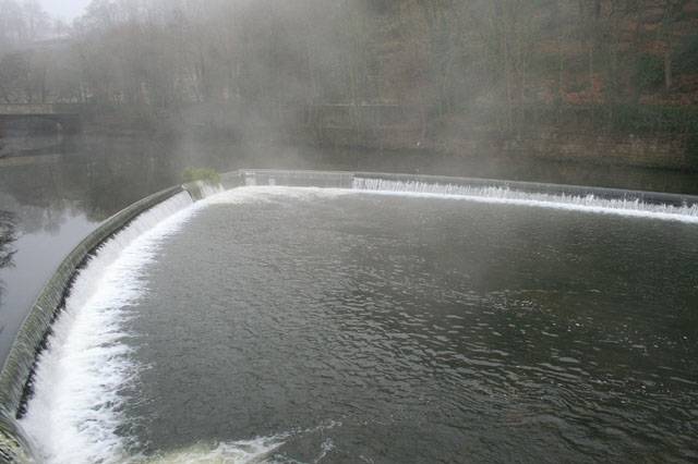
The route then continues north into the countryside along the Midshires Way before turning east to visit Milford. It's a pretty riverside village with an old bridge and rushing weirs. You can cross the bridge to visit nearby Makeney if you would like to extend the walk.
Postcode
DE56 4JD - Please note: Postcode may be approximate for some rural locationsDuffield Ordnance Survey Map  - view and print off detailed OS map
Duffield Open Street Map  - view and print off detailed map
Duffield OS Map  - Mobile GPS OS Map with Location tracking
Duffield Open Street Map  - Mobile GPS Map with Location tracking
Walks near Duffield
- Ecclesbourne Way - A walk through the Ecclesbourne Valley from Duffield to Wirksworth.
- Derwent Valley Heritage Way - Follow the River Derwent through the Derbyshire Peak District on this stunning walk
- Cromford Canal - Enjoy a waterside stroll along the Cromford Canal on this easy walk in Derbyshire
- Shining Cliff Woods - Enjoy waymarked walking trails through this peaceful woodland near Ambergate
- Allestree Park - This large park in Derby covers 320 acres and includes miles of good footpaths for walkers to try
- Kedleston Hall - Explore the 820 acres of parkland surrounding this country house near Derby in the Peak District
- Carsington Water - This route follows the circular cycling and walking trail around Carsington Water in Ashbourne, Derbyshire
- Midland Railway Centre - This heritage railway in Derbyshire's Butterley has a delightful 35 acre country park with a wide range of wildlife areas and great views of the passing steam trains
- Alfreton - The town of Alfreton is located in the Amber Valley district of Derbyshire
- Alport Castles - This walk visits this extraordinary geological feature in the Peak District National Park
- Kedleston Hall - Explore the 820 acres of parkland surrounding this country house near Derby in the Peak District
- Codnor Park Reservoir - This walk visits the Codnor Park Reservoir in Derbyshire
- Little Eaton - This Derbyshire based village is a pleasant place for a walk with riverside trails and the expansive Allestree Park park to explore.
- Great Northern Greenway - This is the first open section of the Great Northern Greenway, running between Derby City and Breadsall
Pubs/Cafes
Head to the Bridge Inn for some post walk refreshment. The inn has a fine menu and is in a lovely spot overlooking the River Derwent. In warmer months you can sit outside in the lovely garden area and enjoy a view over the water with your meal. You can find them at Duffield Bank with a postcode of DE56 4BG for your sat navs.
Dog Walking
The meadows are a popular place for dog walkers so you'll probably see other owners on a fine day.
Further Information and Other Local Ideas
The popular Ecclesbourne Valley Railway passes through the town. The heritage steam railway is a great way of exploring the area.
Head north and you could visit the neighbouring town of Belper and try the Around Belper Walk. This uses sections of the Derwent Valley Heritage Way and the Midshires Way to visit the popular Cromford Canal and the nearby Shining Cliff Woods.
For more walking ideas in the areas see the Belper Walks and the Derbyshire Walks pages.
Photos
Duffield Castle is/was an 11th century stone motte and bailey fortress, founded by Henry de Ferrers, Earl of Derby. The castle was destroyed in the 13th century and not much survives other than a few areas of tarmac and concrete showing the outlines.
Chevinend. This track runs along a high ridge overlooking the Derwent valley just north of Duffield. Chevin golf course extends up onto the ridge and enjoys spectacular views over Duffield and down the valley to Derby.


